
LZ North
500+
Downloads

Everyone
info


About this app
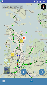
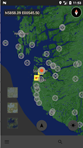
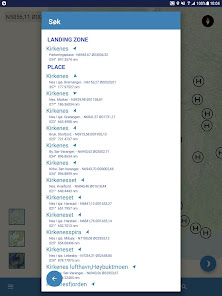
This Application is made for the National Air Ambulance Services of Norway and its operators and partners in order for them to find and maintain Landing Zone information while operating off base.
The App includes high resolution maps over Norway, including overview of aviation obstacles and pictures at/around each landing zone.
The access to use the application is restricted to user groups and companies/operators which are approved by the National Air Ambulance Services of Norway.
The App includes high resolution maps over Norway, including overview of aviation obstacles and pictures at/around each landing zone.
The access to use the application is restricted to user groups and companies/operators which are approved by the National Air Ambulance Services of Norway.
Updated on
Safety starts with understanding how developers collect and share your data. Data privacy and security practices may vary based on your use, region, and age. The developer provided this information and may update it over time.

No data shared with third parties
Learn more about how developers declare sharing

No data collected
Learn more about how developers declare collection
What's new
Version 1.0.1
Bug fix crash download
Bug fix crash download
App support
phone
Phone number
+4751939500