
BayCurrents
100+
Téléchargements

Tout public
info


À propos de l'application
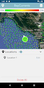
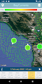
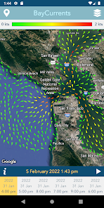
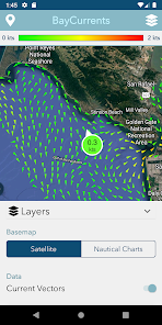
Baycurrents is a mobile app for displaying maps of high resolution surface currents within the San Francisco Bay. The app is intended to support a wide range of maritime activities, from recreational fishing and sailing to the operation of professional transport vessels. The source for the surface current data is a numerical model operated by the National Oceanic & Atmospheric Administration (NOAA). The model benefits from oceanographic high-frequency radar (HFR) measurements from the Central & Northern California Ocean Observing System (CeNCOOS) HFR Network, along with the other observations such as tides and wind. The resulting dataset contains current vector fields for hourly timestamps ranging from the recent past, to the present and up to 48 hours in the future. The complete vector dataset is downloaded by the app to allow autonomous offline operation.
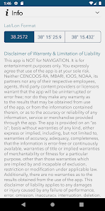
This app contains experimental data and is NOT for navigational purposes.
This app contains experimental data and is NOT for navigational purposes.
Date de mise à jour
La sécurité, c'est d'abord comprendre comment les développeurs collectent et partagent vos données. Les pratiques concernant leur confidentialité et leur protection peuvent varier selon votre utilisation, votre région et votre âge. Le développeur a fourni ces informations et peut les modifier ultérieurement.

Aucune donnée partagée avec des tiers
En savoir plus sur la manière dont les développeurs déclarent le partage

Aucune donnée collectée
En savoir plus sur la manière dont les développeurs déclarent la collecte
Nouveautés
Added support for latest Android version.
