
История поля
5K+
Downloads

Everyone
info


About this app
This application is part of the online service to manage the history of the field of the agricultural enterprise.
Key features:
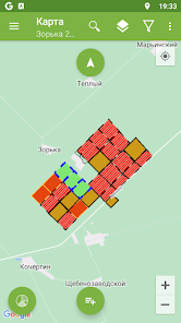
View map fields with coloring crop
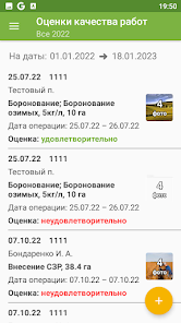
View planned and carried out operations in the fields
Viewing allocated for terrestrial viewing zones on fields
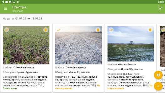
Photographic images of pests, diseases and other objects found in the fields
View the weather information in the fields
Display of sample points for agrohimanaliza and routes them to detour
Ability to work in standalone mode without access to the Internet.
To gain full access to the service, send a request for agrohistory@geomir.ru
Key features:
View map fields with coloring crop
View planned and carried out operations in the fields
Viewing allocated for terrestrial viewing zones on fields
Photographic images of pests, diseases and other objects found in the fields
View the weather information in the fields
Display of sample points for agrohimanaliza and routes them to detour
Ability to work in standalone mode without access to the Internet.
To gain full access to the service, send a request for agrohistory@geomir.ru
Updated on
Safety starts with understanding how developers collect and share your data. Data privacy and security practices may vary based on your use, region, and age. The developer provided this information and may update it over time.

No data shared with third parties
Learn more about how developers declare sharing

No data collected
Learn more about how developers declare collection

Data isn’t encrypted
Data can’t be deleted