Vega Pilot
10+
Downloads

Everyone
info


About this app
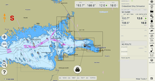
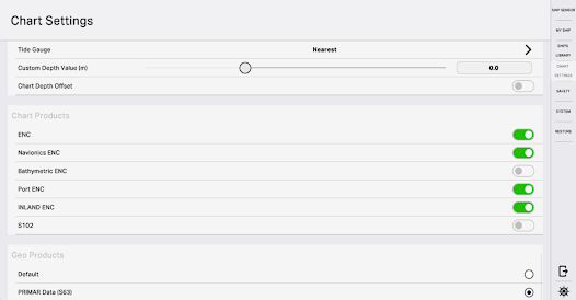
PRIMAR CARDS
Quick and easy installation of ENC PRIMAR electronic nautical charts - at the location of the vessel, along the current or arbitrary route or by arbitrary choice.
3D SEA AND LAND CHARTS
3D sea and land maps, 3D seabed, land relief, 3D models of buildings, ships and infrastructure for better orientation of boatmasters.
ROUTE PLANNING
Save time with built-in sea and river routes based on security checks.
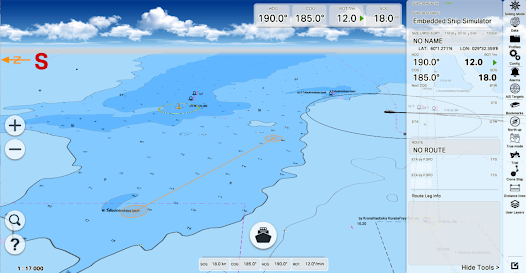
SEA TRAFFIC
Traffic data received over the Internet via AIS streams to display, identify and alert dangerous targets.
COMPASS MODE
Efficient use of visual aids for ship navigation with support for virtual reality mode.
Quick and easy installation of ENC PRIMAR electronic nautical charts - at the location of the vessel, along the current or arbitrary route or by arbitrary choice.
3D SEA AND LAND CHARTS
3D sea and land maps, 3D seabed, land relief, 3D models of buildings, ships and infrastructure for better orientation of boatmasters.
ROUTE PLANNING
Save time with built-in sea and river routes based on security checks.
SEA TRAFFIC
Traffic data received over the Internet via AIS streams to display, identify and alert dangerous targets.
COMPASS MODE
Efficient use of visual aids for ship navigation with support for virtual reality mode.
Updated on
Safety starts with understanding how developers collect and share your data. Data privacy and security practices may vary based on your use, region, and age. The developer provided this information and may update it over time.


What’s new
Запрос фоновового определения местоположения
App support
About the developer
MIT, OOO
support@veganav.ru
d. 4 litera B pom. 6N kom. 3, prospekt Sredni V.O.
St. Petersburg
Russia
199004
+7 921 576-27-33