PickALine
1K+
Downloads

Everyone
info


About this app
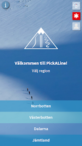
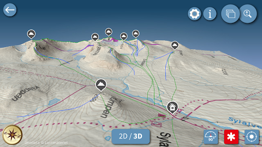
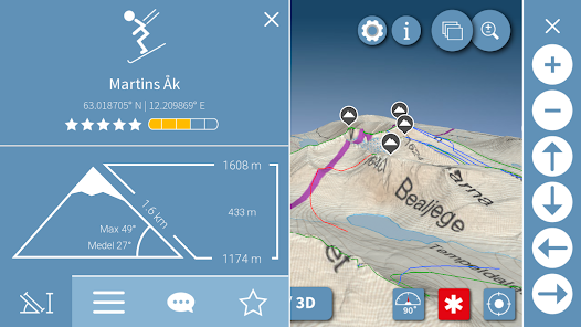
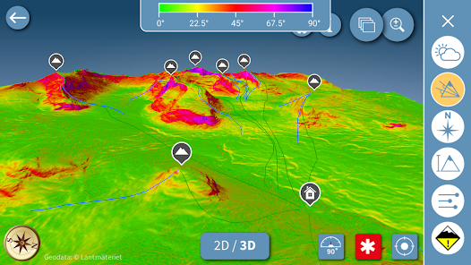
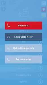
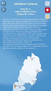
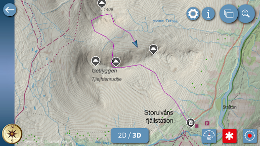
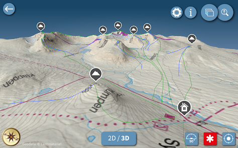
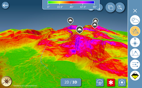
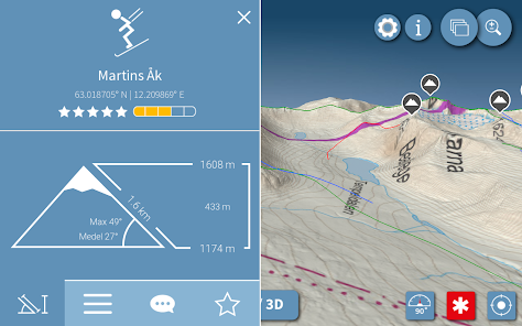
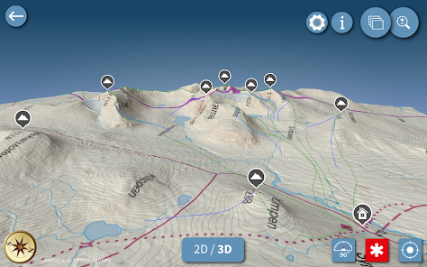
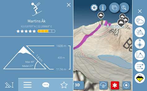
Pecking Line is an app for ski mountaineers and topptursentusiaster as well as for the less experienced who want to look beyond the slopes. It is the perfect source of information both for planning the tour and also an excellent tool well in place in the mountains. Understand and familiarize yourself with the Swedish mountain terrain before you set out in it. With detailed 3D maps of the most popular topptursområdena you can explore the mountains as never before. With the help of visual inventory provides information on inclination, the compass, and elevation. Integrated with avalanche forecasts can see which areas are particularly vulnerable under the circumstances. And with one-touch emergency calls and the ability to text your current position, it is easy to call for help in an accident or find back your friends.
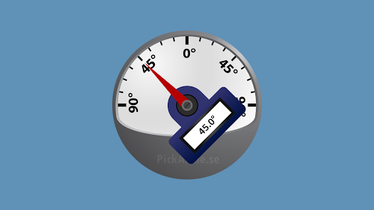
With the built-in GPS you can easily see where you are and have the ability to record your route and share it with others when you are finished riding. If you are sitting on some awesome rides that are missing in the app, you can easily add those on the website and they will be visible to all. With inclinometer directly to the mobile app is the complete tool in the mountains!
With the built-in GPS you can easily see where you are and have the ability to record your route and share it with others when you are finished riding. If you are sitting on some awesome rides that are missing in the app, you can easily add those on the website and they will be visible to all. With inclinometer directly to the mobile app is the complete tool in the mountains!
Updated on
Safety starts with understanding how developers collect and share your data. Data privacy and security practices may vary based on your use, region, and age. The developer provided this information and may update it over time.

No data shared with third parties
Learn more about how developers declare sharing

This app may collect these data types
Location, Personal info and 2 others

Data is encrypted in transit
What's new
Höjdkurvor för åk och rutter, där du även kan se din egen position om du är tillräckligt nära
Hantering av kartlager är uppdaterad, du kan nu ha lantmäteriets topografiska karta som bakgrund till informationslagren
Ny meny för karthantering
Snabbknapar för väder och lavinprognoser
Fixat en bugg där appen slutade spela in rutt när appen dog, nu görs ruttinspelningen i en separat service
Hantering av kartlager är uppdaterad, du kan nu ha lantmäteriets topografiska karta som bakgrund till informationslagren
Ny meny för karthantering
Snabbknapar för väder och lavinprognoser
Fixat en bugg där appen slutade spela in rutt när appen dog, nu görs ruttinspelningen i en separat service
App support
phone
Phone number
+46730280182