
Fältreg
5K+
Downloads

Everyone
info


About this app
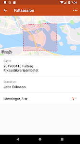
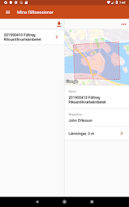
Field Law is a field registration tool for professional archaeologists and administrators in the County Administrative Board who are authorized to the National Heritage Board's cultural environment register.
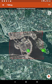
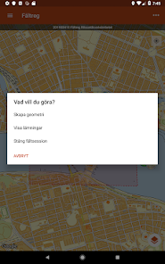
Field Law is integrated with the National Heritage Board's registration tool Reg. With Fieldreg, you measure and describe the leave in the field. You can work both online and offline. The information is then transferred to Fornreg where it is registered.
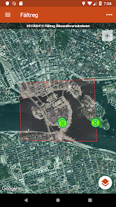
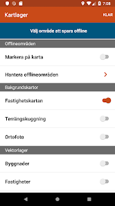
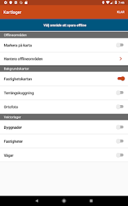
Field law contains several types of background maps and it is also possible to save sections of these maps to work offline. You can also add your own vector layers and raster maps, such as rectified historical maps.
You can use your device's built-in GPS or connect an external GPS.
You can find instructions on how to use Fieldregreg here: https://www.raa.se/fornreg/
Field Law is integrated with the National Heritage Board's registration tool Reg. With Fieldreg, you measure and describe the leave in the field. You can work both online and offline. The information is then transferred to Fornreg where it is registered.
Field law contains several types of background maps and it is also possible to save sections of these maps to work offline. You can also add your own vector layers and raster maps, such as rectified historical maps.
You can use your device's built-in GPS or connect an external GPS.
You can find instructions on how to use Fieldregreg here: https://www.raa.se/fornreg/
Updated on
Safety starts with understanding how developers collect and share your data. Data privacy and security practices may vary based on your use, region, and age. The developer provided this information and may update it over time.

No data shared with third parties
Learn more about how developers declare sharing

This app may collect these data types
Personal info

Data is encrypted in transit

You can request that data be deleted
What's new
* Nu inriktad mot Android 12
* 🐛 Åtgärdat bugg som gjorde att kompassen doldes
* 🐛 Åtgärdat bugg som gjorde att kompassen doldes