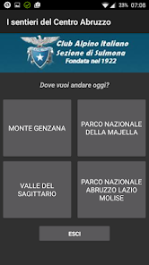
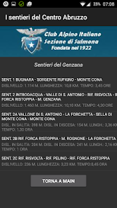
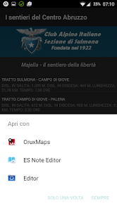
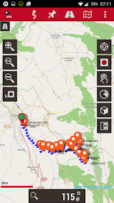
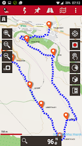
I Sentieri del Centro Abruzzo

5K+
Downloads
Content rating
Everyone
Screenshot image
Screenshot image
Screenshot image
Screenshot image
Screenshot image
Screenshot image
Screenshot image

About this app

Born from the collaboration between the Sulmona Section of the CAI - Club Alpino Italino (http://www.caisulmona.it) and the software house Archimede - A.S.I. srl (http://www.arc.it) this app allows the easy and intuitive management of an archive of gps tracks. Over 1,300 km of trails in gpx format are collected in a single app.
The tracks available are related to the paths of Monte Genzana, the Sagittario Valley, the Abruzzo Lazio and Molise National Park and the Majella National Park.
Within the section relating to the Majella there are 4 thematic sections: The path of freedom, the stone huts, the paths of the spirit, the paths of the park.
IT IS NOT A NAVIGATION PROGRAM but a very powerful data archive which, based on the user's choice, provides the data of the selected route directly to the user's preferred navigation program.
Any gps navigation program capable of reading gpx tracks MUST BE INSTALLED on the device.
At the first start, the association with a navigation program is requested.
The application has been tested with almost all free gps apps.

The program has been designed to optimize the battery consumption of the terminal, in fact DURING USE IT DOES NOT REQUIRE ANY INTERNET CONNECTION, ONLY GPS LOCATION.
Updated on
Jun 19, 2021

Data safety

Safety starts with understanding how developers collect and share your data. Data privacy and security practices may vary based on your use, region, and age. The developer provided this information and may update it over time.
No data shared with third parties
Learn more about how developers declare sharing
No data collected
Learn more about how developers declare collection

What's new

Aggiornate alcune librerie di sistema