
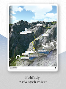
Zaži Tatry
4.6star
442 reviews
50K+
Downloads

Everyone
info


About this app
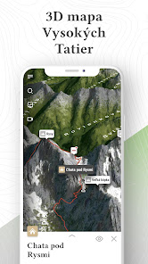
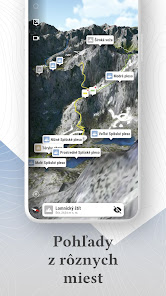
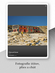
Get to know the Tatras as few before you - from the bird's eye view and without the internet! You will find more than 180 peaks, 70 lakes, 16 waterfalls, 21 cottages and mountain hotels. All this in 67 valleys.
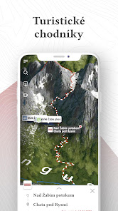
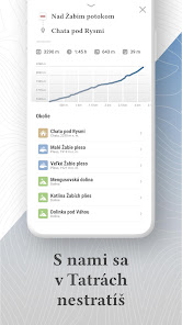
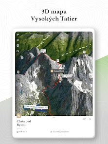
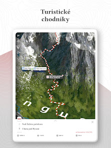
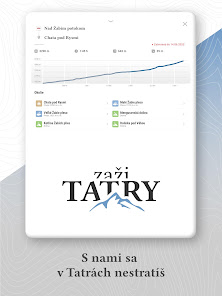
Choose one of the 205 hiking trails, from a total length of 407 kilometres. The app will show you your current location and elevation.
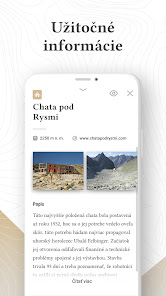
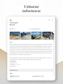
Meet the history of the Tatras, the legends of their origin, but also the current life in them. Interesting information will make every tour an unforgettable experience.
Choose one of the 205 hiking trails, from a total length of 407 kilometres. The app will show you your current location and elevation.
Meet the history of the Tatras, the legends of their origin, but also the current life in them. Interesting information will make every tour an unforgettable experience.
Updated on
Safety starts with understanding how developers collect and share your data. Data privacy and security practices may vary based on your use, region and age The developer provided this information and may update it over time.

No data shared with third parties
Learn more about how developers declare sharing

This app may collect these data types
Personal info and App info and performance

Data is encrypted in transit
Ratings and reviews
4.6
442 reviews

peter pilko
- Flag inappropriate
03 July 2020
Just google earth maps with hiking trails. Resolution so low, practically unusable for any navigation. No gps too. 5 minutes and goes to trash.
2 people found this review helpful

Peter Sedlacek
- Flag inappropriate
19 September 2023
2 stars for idea and development. It is very uncomfortable to use ... Uninstalled in 5 minutes.

Juraj Horňák
- Flag inappropriate
08 July 2021
Great and original application. Good for hiking trips in High Tatras.
1 person found this review helpful
What's new
Minor improvements and fixes.