
fiResponse Texas

Everyone
info
100+
Downloads


About this app
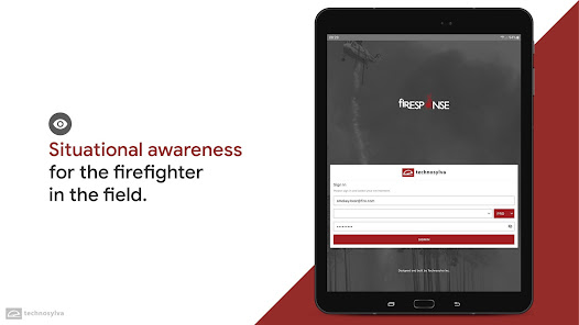
fiResponse ™ is a multi-platform common operational picture that assimilates data from the field in real-time with other relevant detection data sources. Advanced incident mapping and editing functionality extends capabilities into the field even for disconnected situations within a location-aware app.
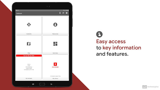
Key Features:
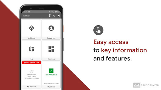
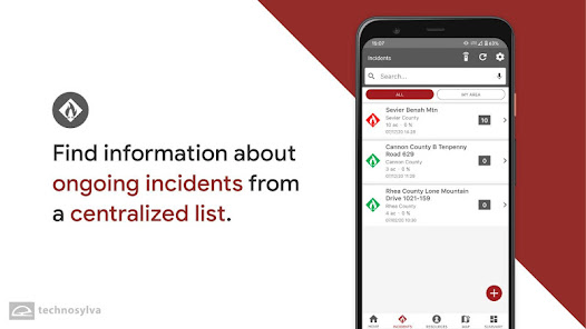
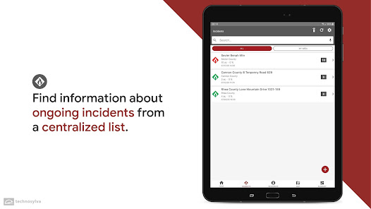
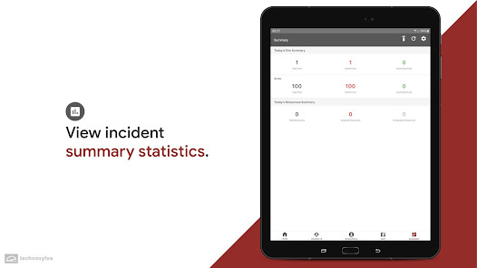
- Provide incident and resource data for the field user
- Download maps and work offline
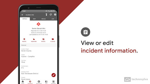
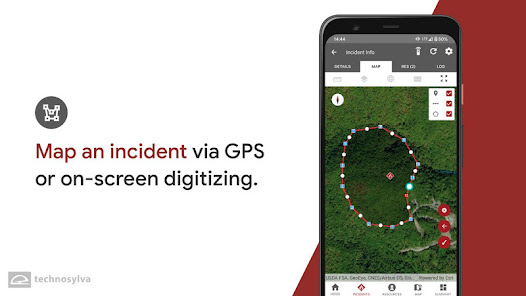
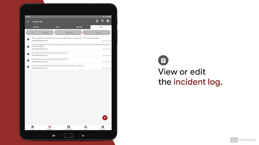
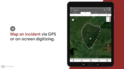
- Collect incident mapping data including points, lines, and polygons using location data or by digitizing on screen
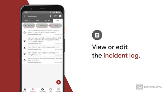
- Attach and view photos and documents
- Share messages between users
- View your location and the location of other responders
- Share coordinates and mapping data with other users
This app requires access to shared storage for locating and loading map files such as tpk, mmpk, and vtpk files to provide critical map data for offline use.
Note: This app requires you have a fiResponse account with the host agency to login and view/edit information.
Key Features:
- Provide incident and resource data for the field user
- Download maps and work offline
- Collect incident mapping data including points, lines, and polygons using location data or by digitizing on screen
- Attach and view photos and documents
- Share messages between users
- View your location and the location of other responders
- Share coordinates and mapping data with other users
This app requires access to shared storage for locating and loading map files such as tpk, mmpk, and vtpk files to provide critical map data for offline use.
Note: This app requires you have a fiResponse account with the host agency to login and view/edit information.
Updated on
Safety starts with understanding how developers collect and share your data. Data privacy and security practices may vary based on your use, region, and age. The developer provided this information and may update it over time.

No data shared with third parties
Learn more about how developers declare sharing

This app may collect these data types
Location, Personal info and 6 others

Data is encrypted in transit

You can request that data be deleted
What’s new
- Fix to enable notifications for SSO users
App support
About the developer
TECHNOSYLVA INC.
technosylvadevelopment@technosylva.com
7590 Fay Ave Ste 300
La Jolla, CA 92037
United States
+1 888-418-3246


