RIDGID Trax
5K+
Downloads

PEGI 3
info


About this app
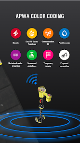
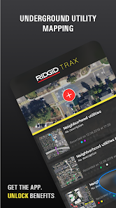
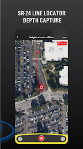
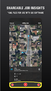
RIDGID Trax is a tool that allows for basic underground utility mapping in real-time. By wirelessly connecting a mobile device via Bluetooth to a RIDGID SR-24 Utility Locator, RIDGID Trax can provide the GPS position and depth of the target utility. Not only can you identify the type of utility, such as water, gas, or electric, but multiple utilities can also be displayed on the same map. Additionally, a finished map can be saved and viewed within the app, or exported to a *.KML file which can be used with popular GIS programs.
Updated on
Safety starts with understanding how developers collect and share your data. Data privacy and security practices may vary based on your use, region, and age. The developer provided this information and may update it over time.

No data shared with third parties
Learn more about how developers declare sharing

This app may collect these data types
Location, App activity and 2 others

Data is encrypted in transit

Data can’t be deleted
What’s new
Bug fixes and stability improvement.
App support
About the developer
Emerson Professional Tools, LLC
irina.stef@emerson.com
9877 Brick Church Rd
Cambridge, OH 43725-9420
United States
+49 2191 9071077


