
Mgrs & Utm Map Pro
4.8star
1.91K reviews
10K+
Downloads

Everyone
info


About this app
Special features at pro version:
👉 More maps (Bicycle, Topographic, Neighborhood, Atlas etc.)
👉 You can see the altitude profile of your route on the chart
👉 You can search for locations by address
👉 You can create different layers for your different activities
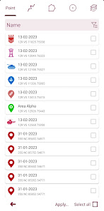
👉 List view for markers, routes, areas and KML
👉 You can draw multiple routes and areas, and change their colors
👉 More and colorful pointer icons
👉 Name or icon display options for markers
👉 Multiple routes can be recorded with the GPS recorder
👉 And no ads
This application is GPS and coordinate systems helper especially for military personnel.
It is also a complete helper for mountaineering, trekking and hiking, cross running, scouting, hunting, fishing, geocaching, off-road navigation and all other outdoor activities and sports.
With satellite navigation systems such as GPS, GALILEO and GLONASS (GNSS) supported by your device and your sensors, you can see your most accurate position on different map layers.
Features:
* Easy and Faster
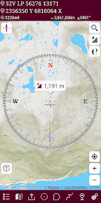
* Compass.
=> Compass on map (on the map that shows your direction)
=> Compass only (shows physical directions)
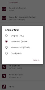
=> Angular units for compass (degrees, grad and mil)
* Follow Mode
=> The center of the map follows your location while on the move.
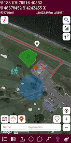
* You can add and removing markers.
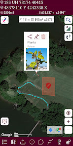
* Distance measure. (You can add custom route and calculate total distance)
* Area measure.(You can select an area on the map and calculate the area in square meters)
* You can see the altitude of your location.
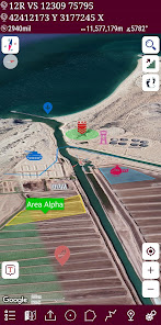
* You can find the location according to Address, Degree/Minute/Second , MGRS, UTM or Latitude/Longitude formats.
* Location (Coordinate) unit options.
=> MGRS / U.S. National Grid (USNG) (WGS84/NAD83)
=> D°M'S" (WGS84)
=> Latitude/Longitude (WGS84)
=> UTM (WGS84/NAD83)
=> SK42(Gauss Kruger)
=> British National Grid(OSNG)
=> Irish Grid Reference
=> ED50
=> ITRF
* Map type options (Road,Terrain,Satellite,Night Mode,Hybrid)
* You can share location coordinate.
* Distance unit options. (meter and feet).
* KML viewer. (Export and import KML layers).
👉 More maps (Bicycle, Topographic, Neighborhood, Atlas etc.)
👉 You can see the altitude profile of your route on the chart
👉 You can search for locations by address
👉 You can create different layers for your different activities
👉 List view for markers, routes, areas and KML
👉 You can draw multiple routes and areas, and change their colors
👉 More and colorful pointer icons
👉 Name or icon display options for markers
👉 Multiple routes can be recorded with the GPS recorder
👉 And no ads
This application is GPS and coordinate systems helper especially for military personnel.
It is also a complete helper for mountaineering, trekking and hiking, cross running, scouting, hunting, fishing, geocaching, off-road navigation and all other outdoor activities and sports.
With satellite navigation systems such as GPS, GALILEO and GLONASS (GNSS) supported by your device and your sensors, you can see your most accurate position on different map layers.
Features:
* Easy and Faster
* Compass.
=> Compass on map (on the map that shows your direction)
=> Compass only (shows physical directions)
=> Angular units for compass (degrees, grad and mil)
* Follow Mode
=> The center of the map follows your location while on the move.
* You can add and removing markers.
* Distance measure. (You can add custom route and calculate total distance)
* Area measure.(You can select an area on the map and calculate the area in square meters)
* You can see the altitude of your location.
* You can find the location according to Address, Degree/Minute/Second , MGRS, UTM or Latitude/Longitude formats.
* Location (Coordinate) unit options.
=> MGRS / U.S. National Grid (USNG) (WGS84/NAD83)
=> D°M'S" (WGS84)
=> Latitude/Longitude (WGS84)
=> UTM (WGS84/NAD83)
=> SK42(Gauss Kruger)
=> British National Grid(OSNG)
=> Irish Grid Reference
=> ED50
=> ITRF
* Map type options (Road,Terrain,Satellite,Night Mode,Hybrid)
* You can share location coordinate.
* Distance unit options. (meter and feet).
* KML viewer. (Export and import KML layers).
Updated on
Safety starts with understanding how developers collect and share your data. Data privacy and security practices may vary based on your use, region and age. The developer provided this information and may update it over time.


Ratings and reviews
4.8
1.82K reviews

Clayton Noble
- Flag inappropriate
- Show review history
16 July 2025
Best app on the market for working with MGRS I'd also love if the developers would give a more dedicated icon list for first responders. I've used the app several times for pushing info regarding control burns and when dealing with larger scale fires being able to mark pumper locations, water refill sites and flow direction would be outstanding but a few more first response vehicle icons would dramatically improve the speed of building overlays specially when time if important
1 person found this review helpful

Sam Davis
- Flag inappropriate
9 June 2025
this app is incredible. I use it frequently to assist with fire direction safety and target analysis. Pro tip: find a gridded map of your base or training area, convert the PDF to a kml file and add it as a layer.

Garret LaMay
- Flag inappropriate
- Show review history
15 July 2025
love this app been using it for years. would be great if I could send map data to IOS or download the app on IOS devices for work.
App support
phone
Phone number
+905413857349
About the developer
Zahid Çataltaş
zhdctlts@gmail.com
İstiklal mahallesi, 1170 sokak, no:18, daire 6, Pamukkale , Denizli
Cinkaya Yapı 1
20000 Ege/Denizli
Türkiye
undefined


