
SAHM
500+
Downloads

Everyone
info
About this app
Using satellite image processing by the SAHM system, the following reports are sent to users in this application.
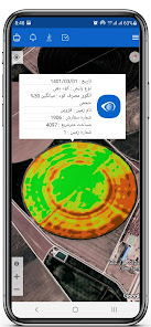
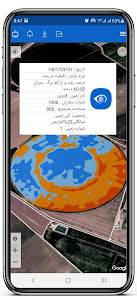
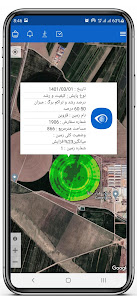
Precision Agriculture:
Register your farmland. So that we can send you the quality and growth of the plant, estimation, temperature, fertilization consumption pattern, water consumption pattern.
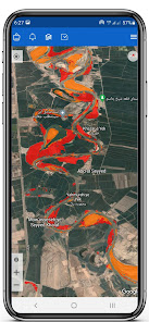
Flood forecasting
Flood zoning
Flood damage estimation
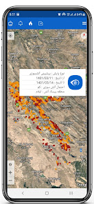
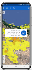
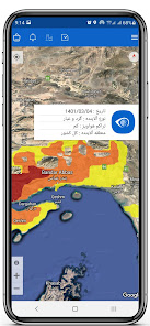
Fire prediction
Detect active fire points
Quick mapping of burned area
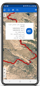
Changing the level of water resources
Land use change
Detection of oil slicks
Dust and nitrogen dioxide
Precision Agriculture:
Register your farmland. So that we can send you the quality and growth of the plant, estimation, temperature, fertilization consumption pattern, water consumption pattern.
Flood forecasting
Flood zoning
Flood damage estimation
Fire prediction
Detect active fire points
Quick mapping of burned area
Changing the level of water resources
Land use change
Detection of oil slicks
Dust and nitrogen dioxide
Updated on
Safety starts with understanding how developers collect and share your data. Data privacy and security practices may vary based on your use, region and age The developer provided this information and may update it over time.

No data shared with third parties
Learn more about how developers declare sharing

No data collected
Learn more about how developers declare collection

Data is encrypted in transit


