WairToNow
100+
Downloads

Everyone
info


About this app
Open-source aviation mapping program, no-nonsense basics with minimum bells and whistles. Includes geo-referenced airport diagrams and approach plates. Source on https://github.com/mrieker/WairToNow
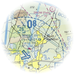
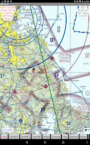
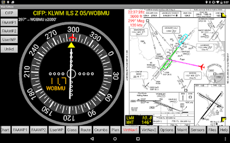
App covers areas covered by US charts, including sectionals, terminal area charts, helicopter charts and what's left of world charts. Also included is mapping via OpenStreetMaps for walking/biking to nearby $100 hamburger stands, as well as georeferenced approach plates and airport diagrams. Also provides OpenStreetMap-backed runway diagrams for all airports, though they are primarily used for those airports that don't have official FAA-provided airport diagram plates. Approach plates include an optional on-screen DME display that the user can configure.
Also covers parts of Europe using charts from https://www.openflightmaps.org and provides access to plates from Eurocontrol. The Eurocontrol plates are not geo-referenced but you can manually input your own geo-referencing information for plates you anticipate using.
Server provides scripts to populate and operate a server, fetching the required data from online sources. The scripts should be run every 28 days. Server code available on https://github.com/mrieker/WairToNow if you want to set up your own.
Updated on
Safety starts with understanding how developers collect and share your data. Data privacy and security practices may vary based on your use, region and age The developer provided this information and may update it over time.

No data shared with third parties
Learn more about how developers declare sharing

No data collected
Learn more about how developers declare collection
What's new
don't crash if route on Route page starts with an airway


