
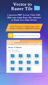
Vector To Raster
In-App-Käufe
10+
Downloads

Jedes Alter
info


Über diese App
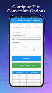
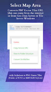
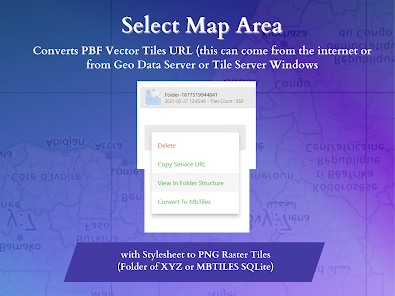
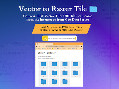
Converts PBF Vector Tiles URL (this can come from internet or from Geo Data Server or Tile Server Windows
Or Tile Server Android ) with Stylesheet to PNG Raster Tiles (Folder of XYZ raster tiles or MBTILES SQLite raster tiles)
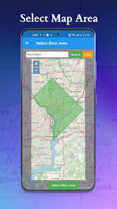
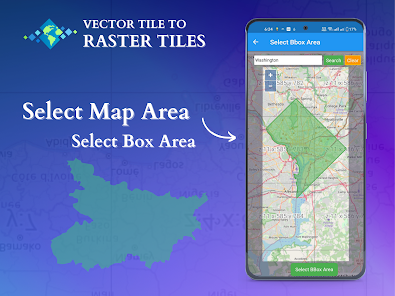
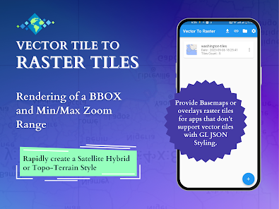
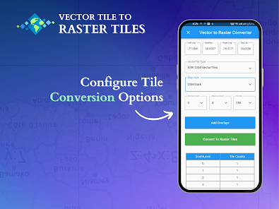
Define your area of interest/operation (BBOX/BOUNDS) and your Min Zoom and Max Zoom Level Range
Works as a background process - enables multiple jobs to run simultaneously.
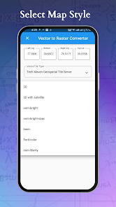
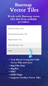
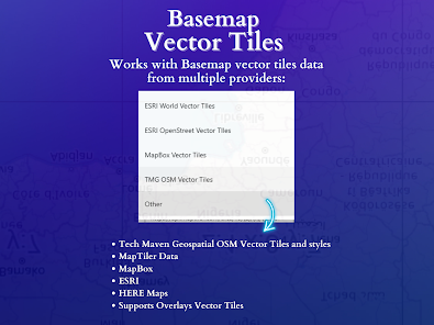
Works with basemap vector tiles data from multiple providers:
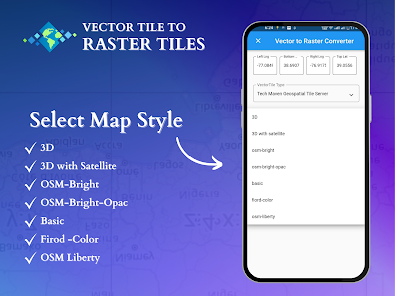
- Tech Maven Geospatial’s OSM Vector Tiles and styles (3D, 3D with Satellite, OSM Bright, Basic, fiord color, osm liberty, positron, toner, dark matter, topo-terrain, opacity styles, ESRI satellite with OSM, HERE Maps Satellite with OSM, OpenMapTiles Satellite with OSM)
- MapTiler Data (basic, bright, outdoor, streets, toner, topo, winter, dataviz, satellite hybrid)
- MapBox (Street, outdoors, Light, Dark, Satellite, Satellite Streets, Navigation Day, Navigation Night)
- ESRI (World navigation, Navigation Dark mode, Light Gray canvas, Dark gray, World terrain, World topographic, national geographic, newspaper, nova, outdoor, ocean, enhanced contrast)
- ESRI OSM (OSM Navigation, OSM Dark, Hybrid OSM)
- Load your own URL/Stylesheet
Supports Overlays Vector Tiles
Easily share converted files and view files with file manager and viewer
Why this is valuable?
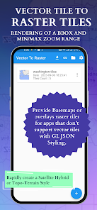
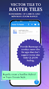
Worldwide OSM Vector Tiles is about 80gb however many mapping applications don’t support vector tiles or complex vector tiles. This allow you to pre-cache an area of interest as Raster Tiles.
Users of apps like ATAK, WINTAK, iTAK, ARTAK and MCH can now have data they can consume.
Users of Mapping Libraries like Cesium WebGL that does not support vector tiles can now support data by converting to raster tiles.
Users of On-Premises or Edge Mapping /Common Operating Picture Solutions can now have rich basemap data made available for their use.
Supports styles with multiple sources (topo/terrain style with contour lines and hillshade or satellite hybrid style or other combination of data)
Or Tile Server Android ) with Stylesheet to PNG Raster Tiles (Folder of XYZ raster tiles or MBTILES SQLite raster tiles)
Define your area of interest/operation (BBOX/BOUNDS) and your Min Zoom and Max Zoom Level Range
Works as a background process - enables multiple jobs to run simultaneously.
Works with basemap vector tiles data from multiple providers:
- Tech Maven Geospatial’s OSM Vector Tiles and styles (3D, 3D with Satellite, OSM Bright, Basic, fiord color, osm liberty, positron, toner, dark matter, topo-terrain, opacity styles, ESRI satellite with OSM, HERE Maps Satellite with OSM, OpenMapTiles Satellite with OSM)
- MapTiler Data (basic, bright, outdoor, streets, toner, topo, winter, dataviz, satellite hybrid)
- MapBox (Street, outdoors, Light, Dark, Satellite, Satellite Streets, Navigation Day, Navigation Night)
- ESRI (World navigation, Navigation Dark mode, Light Gray canvas, Dark gray, World terrain, World topographic, national geographic, newspaper, nova, outdoor, ocean, enhanced contrast)
- ESRI OSM (OSM Navigation, OSM Dark, Hybrid OSM)
- Load your own URL/Stylesheet
Supports Overlays Vector Tiles
Easily share converted files and view files with file manager and viewer
Why this is valuable?
Worldwide OSM Vector Tiles is about 80gb however many mapping applications don’t support vector tiles or complex vector tiles. This allow you to pre-cache an area of interest as Raster Tiles.
Users of apps like ATAK, WINTAK, iTAK, ARTAK and MCH can now have data they can consume.
Users of Mapping Libraries like Cesium WebGL that does not support vector tiles can now support data by converting to raster tiles.
Users of On-Premises or Edge Mapping /Common Operating Picture Solutions can now have rich basemap data made available for their use.
Supports styles with multiple sources (topo/terrain style with contour lines and hillshade or satellite hybrid style or other combination of data)
Aktualisiert am
Was die Sicherheit angeht, solltest du nachvollziehen, wie Entwickler deine Daten erheben und weitergeben. Die Datenschutz- und Sicherheitspraktiken können je nach Verwendung, Region und Alter des Nutzers variieren. Diese Informationen wurden vom Entwickler zur Verfügung gestellt und können jederzeit von ihm geändert werden.

Keine Daten werden mit Drittunternehmen oder -organisationen geteilt

Keine Daten erhoben


