Vindskyddskartan (Shelter Map)
Покупки через додаток
10 тис.+
Завантаження

Для всіх вікових груп
info
Про цей додаток
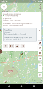
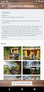
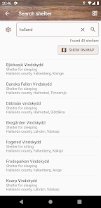
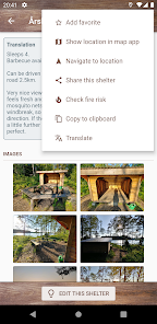
Do you want to enjoy wilderness to the fullest and spend the night outdoors? Or perhaps you're just looking for a nice place to have a "fika pause" during a hike? There are plenty of hiking shelters all around, but finding them is usually not easy.
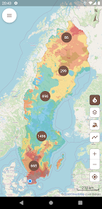
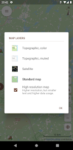
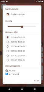
Vindskyddskartan (which means "Shelter map" in Swedish) gives you an easy to use overview of thousands of shelters on a map so you can easily find one near your location. The app also gives you easy access to current and forecasted fire risk and fire ban status, so you know when, where and how you can safely enjoy a campfire and cook food in nature.
The app is subscription based, but you can try it for free for 3 days before paying anything. If you prefer to own your apps, you can make a one-time purchase and have unlimited lifetime access to the app. All purchases are made from within the app. Subscriptions renew automatically unless cancelled at least 24 hours before the next renewal. Active subscriptions are managed from the Google Play app, and of course you may cancel your subscription at any time.
Оновлено
Безпека визначається тим, як додаток збирає та кому передає ваші дані. Способи забезпечення конфіденційності й захисту даних можуть різнитися залежно від використання додатка, регіону та віку користувача. Розробник, який надає цю інформацію, може оновлювати її.

Цей додаток може передавати третім сторонам деякі типи даних
Дії в додатку, Інформація про додаток і його роботу і Ідентифікатори пристрою або інші ідентифікатори

Цей додаток може збирати такі типи даних
Місцезнаходження, Особиста інформація і ще 4

Дані передаються в зашифрованому вигляді

Ви можете надіслати запит на видалення цих даних
Що нового
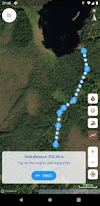
Förbättrad visning av GPX-filer, inklusive förbättrad prestanda för stora filer med långa spår samt visning av rutter och waypoints.


