

Kadal Map - Marine Navigation
In-app purchases

10K+
Downloads

Everyone
info

About this app
Kadal Map – Marine Navigation System
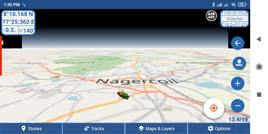
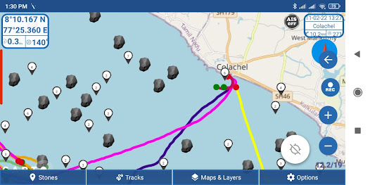
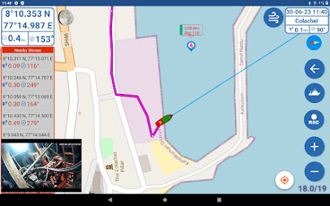
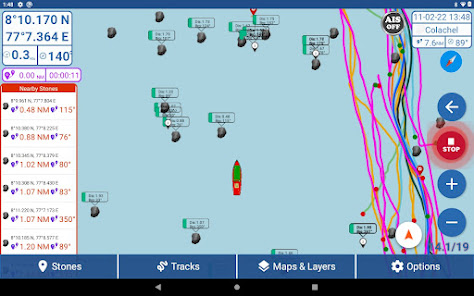
Simple Marine Navigation System designed for fishing boats. Helps you record fishing tracks, find stones under the sea, and navigate with ease.
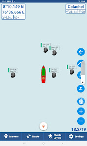
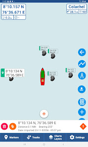
Built-in AIS support lets you view nearby ships directly around your boat.
Features:
• Easy to use
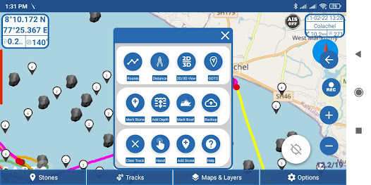
• Unlimited Waypoints
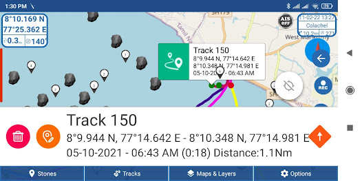
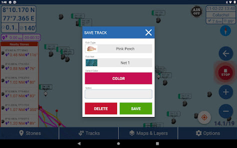
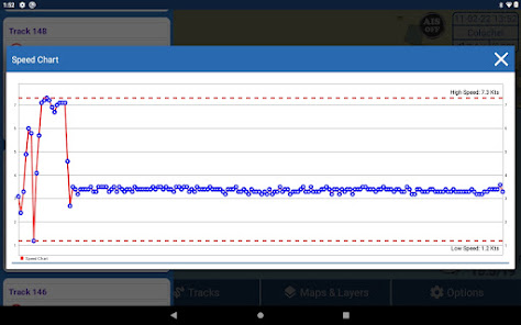
• Unlimited Tracks
• Distance Scale
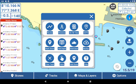
• Create and manage Routes
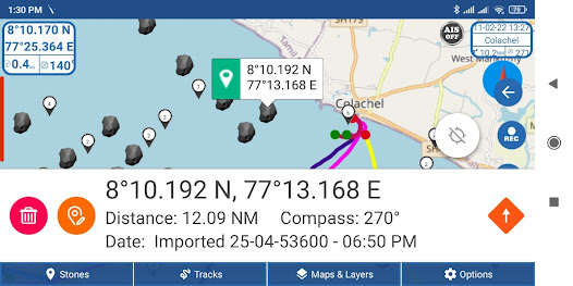
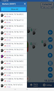
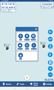
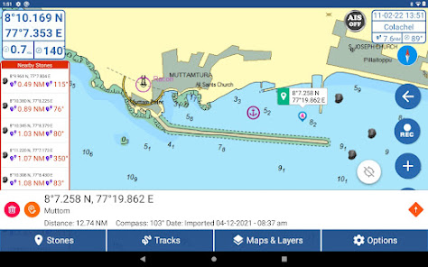
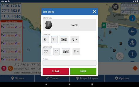
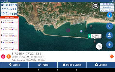
• Add Waypoints, Stones, and Depth easily
• Cloud Backup
• Share Tracks and Stones with friends
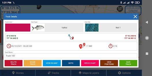
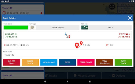
• Save caught fish details with each track
• Works with advanced Bluetooth GPS
• AIS Feature – View nearby ships using an AIS receiver
• Import / Export your Waypoints and Tracks in GPX Format
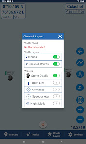
• Import Offline MBTiles Maps for Custom Chart Display
⚠️ Important Notes
• You can import your own MBTiles Charts for offline use.
Make sure that the maps you import are free to use or properly licensed.
Using or distributing copyrighted commercial maps without permission is not allowed.
• When importing GPX files (stones, waypoints, or tracks), users are responsible for the accuracy, ownership, and safety of the data they import or share.
• Kadal Map is not responsible for any loss, damage, or disputes caused by external or user-imported data.
To buy Bluetooth GPS and AIS Receivers, visit: www.kadalmap.com
Simple Marine Navigation System designed for fishing boats. Helps you record fishing tracks, find stones under the sea, and navigate with ease.
Built-in AIS support lets you view nearby ships directly around your boat.
Features:
• Easy to use
• Unlimited Waypoints
• Unlimited Tracks
• Distance Scale
• Create and manage Routes
• Add Waypoints, Stones, and Depth easily
• Cloud Backup
• Share Tracks and Stones with friends
• Save caught fish details with each track
• Works with advanced Bluetooth GPS
• AIS Feature – View nearby ships using an AIS receiver
• Import / Export your Waypoints and Tracks in GPX Format
• Import Offline MBTiles Maps for Custom Chart Display
⚠️ Important Notes
• You can import your own MBTiles Charts for offline use.
Make sure that the maps you import are free to use or properly licensed.
Using or distributing copyrighted commercial maps without permission is not allowed.
• When importing GPX files (stones, waypoints, or tracks), users are responsible for the accuracy, ownership, and safety of the data they import or share.
• Kadal Map is not responsible for any loss, damage, or disputes caused by external or user-imported data.
To buy Bluetooth GPS and AIS Receivers, visit: www.kadalmap.com
Updated on
Safety starts with understanding how developers collect and share your data. Data privacy and security practices may vary based on your use, region, and age. The developer provided this information and may update it over time.

No data shared with third parties
Learn more about how developers declare sharing

This app may collect these data types
Location and Personal info

Data is encrypted in transit

You can request that data be deleted
App support
phone
Phone number
+919500850580
About the developer
J Binu
binu@live.in
Selin Mary Street
Nagercoil, Tamil Nadu 629004
India
undefined


