ActiMap - Outdoor maps & GPS
4.1star
92 reviews
10K+
Downloads

Everyone
info


About this app
*** 14-Day FREE Trial Edition now also available. Search for 'ActiMap FREE' ***
Designed for use in the great outdoors as a GPS and navigation aid, ActiMap is your best companion for outdoor and backcountry activities such as hiking, cycling, mountain biking, ski touring, and most things except caving...
ActiMap comes with a small starter library of online maps (map sources) pre-installed, and with the ability to easily add your own from the ActiMap online map sources library, or manually. The starter library includes:
~ OpenTopoMap: European topographic outdoor maps with contours and hillshading based on OpenStreetMap data
~ HikeBikeMap: Worldwide hike and bike maps based on OpenStreetMap data
~ OpenCycleMap: The OpenStreet cycle map
~ ArcGIS World Topo map: Land cover and World topographic maps from various sources hosted by Esri
With a focus on selected National topographic maps which are not based on OpenStreetMap data, the online map sources library currently includes those for Austria, Belgium, Canada, France, Germany, Great Britain, Italy, New Zealand, Norway, Spain, and the United States. These include:
~ Kompass: National topographic maps of Austria and Germany
~ Norwegian Mapping Authority: National topographic maps of Norway
~ UK Ordnance Survey Landranger and Explorer type outdoor maps from Bing (*)
~ IGN: Topographic maps of France from géoportail
~ USGS topographic maps at 1:100000 and 1:24000 of the USA
You will also find World satellite imagery. This library will be updated regularly, and you can start importing straight away. Be sure to keep coming back!
Regions of maps can be downloaded for use offline, and you can record and display tracks of your journeys.
Look at these other features:
~ Simple interface design specifically for use on the go
~ One tap control of track recording
~ Real-time altitude profile of your current track
~ Add named waypoints to your current track
~ Real-time current location, heading, and track display
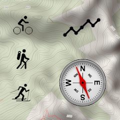
~ Compass with both magnetic and true-North bearings
~ Mini-compass display on the map
~ Low battery usage
~ Download multiple maps simultaneously
~ Pause and resume map downloads
~ Import, export and share downloaded maps
~ Import, export and share GPX files
~ Import, export and share online map source definitions
~ Import and view Garmin Training Center (TCX) tracks
~ Manually add and edit map sources
~ Display multiple tracks and routes in different colours
~ Display points of interest and waypoints
~ Smooth map scrolling
~ Smooth zooming, not limited to fixed zoom levels
~ Map scaling for easier reading of small map fonts
~ Embedded help guide for use offline
~ Note: The ActiMap user interface is currently in English and German (BETA) only
Note: When purchasing ActiMap, you are only purchasing the functionality the app provides, and not a license to use the mapping data. The usage and licensing rights of the maps (and potentially of downloaded GPX tracks) you access are the property of their providers, and you are kindly asked to honour them. All online maps in the starter library and the ActiMap online library are also publicly accessible online for free via their respective websites.
(*) Bing Maps, while publicly accessible at bing.com/maps, requires a key for access within an app such as ActiMap. The embedded ActiMap key is a basic limited-use key. As such, permanent on-going free access to Bing Maps is not guaranteed, and will be reviewed based on usage.
Act Now! Get The Outdoor Map App You Need - ActiMap!
Designed for use in the great outdoors as a GPS and navigation aid, ActiMap is your best companion for outdoor and backcountry activities such as hiking, cycling, mountain biking, ski touring, and most things except caving...
ActiMap comes with a small starter library of online maps (map sources) pre-installed, and with the ability to easily add your own from the ActiMap online map sources library, or manually. The starter library includes:
~ OpenTopoMap: European topographic outdoor maps with contours and hillshading based on OpenStreetMap data
~ HikeBikeMap: Worldwide hike and bike maps based on OpenStreetMap data
~ OpenCycleMap: The OpenStreet cycle map
~ ArcGIS World Topo map: Land cover and World topographic maps from various sources hosted by Esri
With a focus on selected National topographic maps which are not based on OpenStreetMap data, the online map sources library currently includes those for Austria, Belgium, Canada, France, Germany, Great Britain, Italy, New Zealand, Norway, Spain, and the United States. These include:
~ Kompass: National topographic maps of Austria and Germany
~ Norwegian Mapping Authority: National topographic maps of Norway
~ UK Ordnance Survey Landranger and Explorer type outdoor maps from Bing (*)
~ IGN: Topographic maps of France from géoportail
~ USGS topographic maps at 1:100000 and 1:24000 of the USA
You will also find World satellite imagery. This library will be updated regularly, and you can start importing straight away. Be sure to keep coming back!
Regions of maps can be downloaded for use offline, and you can record and display tracks of your journeys.
Look at these other features:
~ Simple interface design specifically for use on the go
~ One tap control of track recording
~ Real-time altitude profile of your current track
~ Add named waypoints to your current track
~ Real-time current location, heading, and track display
~ Compass with both magnetic and true-North bearings
~ Mini-compass display on the map
~ Low battery usage
~ Download multiple maps simultaneously
~ Pause and resume map downloads
~ Import, export and share downloaded maps
~ Import, export and share GPX files
~ Import, export and share online map source definitions
~ Import and view Garmin Training Center (TCX) tracks
~ Manually add and edit map sources
~ Display multiple tracks and routes in different colours
~ Display points of interest and waypoints
~ Smooth map scrolling
~ Smooth zooming, not limited to fixed zoom levels
~ Map scaling for easier reading of small map fonts
~ Embedded help guide for use offline
~ Note: The ActiMap user interface is currently in English and German (BETA) only
Note: When purchasing ActiMap, you are only purchasing the functionality the app provides, and not a license to use the mapping data. The usage and licensing rights of the maps (and potentially of downloaded GPX tracks) you access are the property of their providers, and you are kindly asked to honour them. All online maps in the starter library and the ActiMap online library are also publicly accessible online for free via their respective websites.
(*) Bing Maps, while publicly accessible at bing.com/maps, requires a key for access within an app such as ActiMap. The embedded ActiMap key is a basic limited-use key. As such, permanent on-going free access to Bing Maps is not guaranteed, and will be reviewed based on usage.
Act Now! Get The Outdoor Map App You Need - ActiMap!
Updated on
Safety starts with understanding how developers collect and share your data. Data privacy and security practices may vary based on your use, region, and age. The developer provided this information and may update it over time.

No data shared with third parties
Learn more about how developers declare sharing

No data collected
Learn more about how developers declare collection
Ratings and reviews
4.1
88 reviews

The Camels Butt
- Flag inappropriate
- Show review history
July 6, 2020
Latest version (81) isn't working correctly OS maps just says loading and displays nothing.previous version worked fine
JB Computing Technology Ltd
July 7, 2020
I am sorry to hear you are having problems with this release. Can I please ask that you try version 1.8.1.3. If that still fails, then please contact support@jbcomp.co.uk and we will endeavour to resolve this for you. Thank you. JBCT

A Google user
- Flag inappropriate
July 9, 2019
Does exactly what I need: simple topo map viewing.
A Google user
- Flag inappropriate
- Show review history
October 18, 2018
Didn't work at first but then it was awesome
2 people found this review helpful
What’s new
1.8.1.4
~ Fixed an issue whereby the app could sometimes crash when resuming after closing
1.8.1.0 - 1.8.1.3
~ Fixed an issue whereby the app could crash when recovering a corrupt GPX track, for example after loss of power
~ Fixed an issue whereby the ActiMap online map sources library could become inaccessible
~ Added support for more advanced map sources
~ Improved general error and crash reporting
~ Fixed an issue whereby the app could fail to launch in some languages or localizations
App support
About the developer
J.B. COMPUTING TECHNOLOGY LIMITED
support@jbcomp.co.uk
47 Elm Dr Holmes Chapel
CREWE
CW4 7QA
United Kingdom
+44 1477 534112


