
Mapit GIS Professional
Achats via l'appli
10K+
Téléchargements

Tout public
info


À propos de l'application
Mapit GIS Professional: Elevating Your Mapit GIS Experience for Android 11+
Welcome to Mapit GIS Professional, your comprehensive GIS mapping companion. Embrace a new era of spatial data management with cutting-edge features tailored to meet the demands of various applications involving spatial data collection on mobile devices.
Key Features:
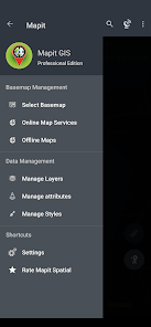
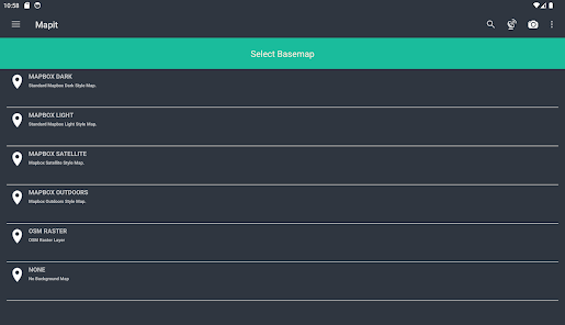
Mapbox SDK Integration:
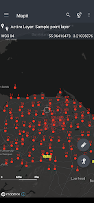
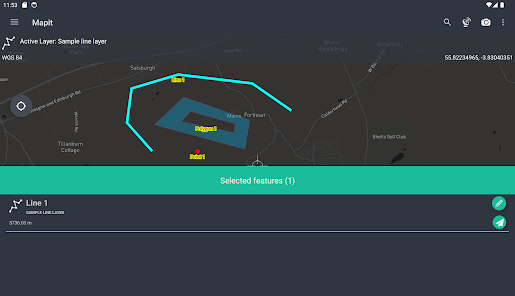
Navigate through spatial data with precision using the Mapbox SDK, providing a visually stunning and powerful mapping experience. Access detailed maps for an accurate representation of your surveyed areas.
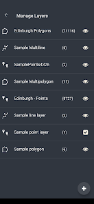
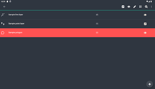
Geopackage Project Efficiency:
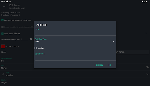
Manage your data effectively through geopackage projects, streamlining survey design and data sharing across different applications. The app's lightweight design ensures optimal performance.
Field Linkage for Enhanced Data Collection:
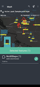
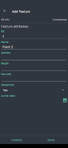
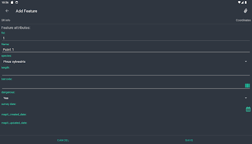
Geopackage feature layers can link fields with attribute set fields, facilitating data collection through forms with drop-down lists, multi-select lists, and barcode scanners. Customize your data collection process according to the unique needs of each application.
Coordinate Precision:
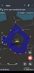
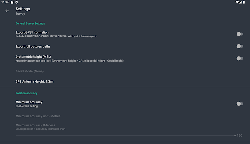
Support for multiple coordinate projections ensures accuracy in diverse environments. Specify your default coordinate system with the EPSG code, leveraging the PRJ4 library for precise coordinate conversion.
High-Precision GNSS Integration:
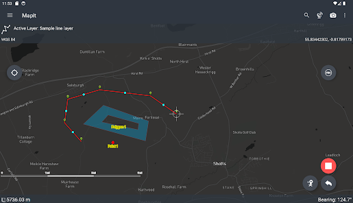
Link with high-precision GNSS systems to achieve centimetre-level accuracy. Take advantage of RTK solutions provided by leading GNSS manufacturers for enhanced surveying capabilities.
Export and Import Flexibility:
Seamlessly export and import data in GeoJSON, KML, and CSV formats, facilitating compatibility with other GIS tools and ensuring smooth collaboration.
Customization Options:
Tailor Mapit GIS Professional to your unique needs by adding custom WMS and WFS services as overlays. Choose from three measurement methods for accurate data capture.
Revolutionized Data Management:
Experience a seamless data management workflow, allowing you to capture, manage, and analyze spatial data effortlessly. The app's redesigned approach ensures efficiency in various GIS applications.
Future-Ready GIS Mapping:
Mapit GIS Professional is committed to continuous improvement.
Please note that while the app is optimized for Android 11+, some features available in older apps may not be available yet.
Stay tuned for our detailed development roadmap on our website, scheduled for release in Q1 2024.
Mapit GIS Professional excels across a spectrum of applications, offering robust solutions for:
Environmental Surveys
Woodland Surveys
Forestry Planning and Woodland Management Surveys
Agriculture and Soil Types Surveys
Road Construction
Land Surveying
Solar Panel Applications
Roofing and Fencing
Tree Surveys
GPS and GNSS Surveying
Site Surveying and Soil Sample Gathering
Snow Removal
Empower your GIS workflows across various sectors and make Mapit GIS Professional your go-to tool for precise spatial data management. Explore the vast potential of GIS mapping across environmental surveys, forestry planning, agriculture, and beyond. Elevate your GIS experience with Mapit GIS Professional today!
Welcome to Mapit GIS Professional, your comprehensive GIS mapping companion. Embrace a new era of spatial data management with cutting-edge features tailored to meet the demands of various applications involving spatial data collection on mobile devices.
Key Features:
Mapbox SDK Integration:
Navigate through spatial data with precision using the Mapbox SDK, providing a visually stunning and powerful mapping experience. Access detailed maps for an accurate representation of your surveyed areas.
Geopackage Project Efficiency:
Manage your data effectively through geopackage projects, streamlining survey design and data sharing across different applications. The app's lightweight design ensures optimal performance.
Field Linkage for Enhanced Data Collection:
Geopackage feature layers can link fields with attribute set fields, facilitating data collection through forms with drop-down lists, multi-select lists, and barcode scanners. Customize your data collection process according to the unique needs of each application.
Coordinate Precision:
Support for multiple coordinate projections ensures accuracy in diverse environments. Specify your default coordinate system with the EPSG code, leveraging the PRJ4 library for precise coordinate conversion.
High-Precision GNSS Integration:
Link with high-precision GNSS systems to achieve centimetre-level accuracy. Take advantage of RTK solutions provided by leading GNSS manufacturers for enhanced surveying capabilities.
Export and Import Flexibility:
Seamlessly export and import data in GeoJSON, KML, and CSV formats, facilitating compatibility with other GIS tools and ensuring smooth collaboration.
Customization Options:
Tailor Mapit GIS Professional to your unique needs by adding custom WMS and WFS services as overlays. Choose from three measurement methods for accurate data capture.
Revolutionized Data Management:
Experience a seamless data management workflow, allowing you to capture, manage, and analyze spatial data effortlessly. The app's redesigned approach ensures efficiency in various GIS applications.
Future-Ready GIS Mapping:
Mapit GIS Professional is committed to continuous improvement.
Please note that while the app is optimized for Android 11+, some features available in older apps may not be available yet.
Stay tuned for our detailed development roadmap on our website, scheduled for release in Q1 2024.
Mapit GIS Professional excels across a spectrum of applications, offering robust solutions for:
Environmental Surveys
Woodland Surveys
Forestry Planning and Woodland Management Surveys
Agriculture and Soil Types Surveys
Road Construction
Land Surveying
Solar Panel Applications
Roofing and Fencing
Tree Surveys
GPS and GNSS Surveying
Site Surveying and Soil Sample Gathering
Snow Removal
Empower your GIS workflows across various sectors and make Mapit GIS Professional your go-to tool for precise spatial data management. Explore the vast potential of GIS mapping across environmental surveys, forestry planning, agriculture, and beyond. Elevate your GIS experience with Mapit GIS Professional today!
Date de mise à jour
La sécurité, c'est d'abord comprendre comment les développeurs collectent et partagent vos données. Les pratiques concernant leur confidentialité et leur protection peuvent varier selon votre utilisation, votre région et votre âge. Le développeur a fourni ces informations et peut les modifier ultérieurement.

Aucune donnée partagée avec des tiers
En savoir plus sur la manière dont les développeurs déclarent le partage

Cette appli peut recueillir ces types de données
Activité dans l'application, Infos et performance des applis

Les données sont chiffrées lors de leur transfert

Impossible de supprimer les données
Nouveautés
CHANGE: App icons improved - themed icons now available.
FIX: Resolved the issue with importing from shape files that affected some users.
FIX: Other minor bugs fixed.
FIX: Resolved the issue with importing from shape files that affected some users.
FIX: Other minor bugs fixed.
Assistance de l'appli
À propos du développeur
MAPIT GIS LTD
feedback@mapitgis.com
80 Walkerburn Drive
WISHAW
ML2 8RY
United Kingdom
+44 7710 394746


