
GPS Altimeter - Altitude App
Reklamalar mavjudIlova ichida xaridlar

4,4star
2,6 ming ta sharh
100 ming+
Yuklanmalar

Hamma uchun
info


Bu ilova haqida
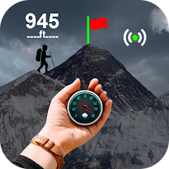
GPS Altimeter - Altitude App is an advanced tool designed for outdoor enthusiasts, hikers, and professionals who require accurate altimeter and location information. 🧭📈
This GPS altitude app is an accurate altimeter that uses GPS and barometric data to provide reliable altitude readings.✔️
This altimeter GPS offline utilizes advanced technology to determine your exact altitude, even in challenging terrain or adverse weather conditions. Whether you're a pilot, a mountain climber, or an outdoor enthusiast, an Accurate Altimeter - GPS Altitude App is an essential tool to help you navigate and stay safe.
One of the vital features of a GPS Altimeter app is its high level of accuracy. With a sensitive GPS receiver, the smart altimeter can provide precise altitude readings for accurate navigation and safe travel. The device may also utilize additional sensors, such as a barometer or an accelerometer, to ensure even greater accuracy and reliability.
🧭Features of the GPS Altimeter - Altitude App:🧭
🕛 Accurate Altimeter;
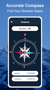
🕛 Digital Compas;
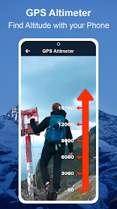
🕛 GPS Altimeter;
🕛 Precise Maps;
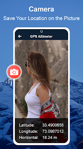
🕛 Save your locations.
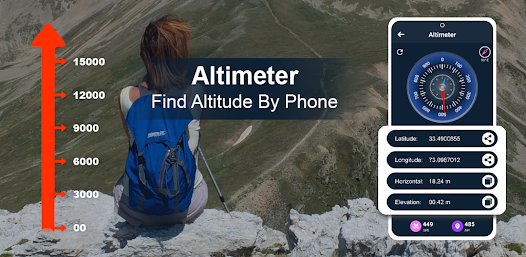
Altimeter GPS offline will provide real-time information about your altitude. This can include your current elevation, rate of ascent or descent, and total ascent or descent distance. This information can be displayed on a clear and easy-to-read screen, allowing you to monitor your altitude and adjust your course as necessary.
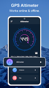
The GPS altitude app's ability to function as an altimeter GPS offline is particularly beneficial for areas with limited or no internet connectivity, making it a necessary tool for outdoor adventures.
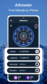
The GPS altimeter feature taps into your device's GPS capabilities to offer precise altitude readings. This technology is beneficial for mapping out hiking trails, surveying land, or any activity where understanding your exact elevation is crucial.
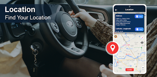
The GPS altitude app provides altitude data, coordinates, and other geographical information, making it a comprehensive smart altimeter tool for navigation and exploration.
Its combination of accurate altimeter technology, GPS altitude app features, and smart altimeter design makes it a top choice for outdoor enthusiasts, travelers, and professionals alike. Whether online or offline, this GPS altimeter app ensures that accurate altitude information is always within reach.
This GPS altitude app is an accurate altimeter that uses GPS and barometric data to provide reliable altitude readings.✔️
This altimeter GPS offline utilizes advanced technology to determine your exact altitude, even in challenging terrain or adverse weather conditions. Whether you're a pilot, a mountain climber, or an outdoor enthusiast, an Accurate Altimeter - GPS Altitude App is an essential tool to help you navigate and stay safe.
One of the vital features of a GPS Altimeter app is its high level of accuracy. With a sensitive GPS receiver, the smart altimeter can provide precise altitude readings for accurate navigation and safe travel. The device may also utilize additional sensors, such as a barometer or an accelerometer, to ensure even greater accuracy and reliability.
🧭Features of the GPS Altimeter - Altitude App:🧭
🕛 Accurate Altimeter;
🕛 Digital Compas;
🕛 GPS Altimeter;
🕛 Precise Maps;
🕛 Save your locations.
Altimeter GPS offline will provide real-time information about your altitude. This can include your current elevation, rate of ascent or descent, and total ascent or descent distance. This information can be displayed on a clear and easy-to-read screen, allowing you to monitor your altitude and adjust your course as necessary.
The GPS altitude app's ability to function as an altimeter GPS offline is particularly beneficial for areas with limited or no internet connectivity, making it a necessary tool for outdoor adventures.
The GPS altimeter feature taps into your device's GPS capabilities to offer precise altitude readings. This technology is beneficial for mapping out hiking trails, surveying land, or any activity where understanding your exact elevation is crucial.
The GPS altitude app provides altitude data, coordinates, and other geographical information, making it a comprehensive smart altimeter tool for navigation and exploration.
Its combination of accurate altimeter technology, GPS altitude app features, and smart altimeter design makes it a top choice for outdoor enthusiasts, travelers, and professionals alike. Whether online or offline, this GPS altimeter app ensures that accurate altitude information is always within reach.
Oxirgi yangilanish
Xavfsizlik — dastur ishlab chiquvchilar maʼlumotlaringizni qanday jamlashi va ulashishini tushinishdan boshlanadi. Maʼlumotlar maxfiyligi va xavfsizlik amaliyotlari ilovadan foydalanish, hudud va yoshga qarab farq qilishi mumkin. Bu axborot dastur ishlab chiquvchi tomonidan taqdim etilgan va keyinchalik yangilanishi mumkin.

Bu ilova tashqi hamkorlarga quyidagi turdagi maʼlumotlarini ulashishi mumkin
Ilova axboroti va unumdorlik va Qurilma yoki boshqa identifikatorlar

Ushbu ilova quyidagi axborot turlarini toʻplashi mumkin
Joylashuv, Ilova axboroti va unumdorlik va Qurilma yoki boshqa identifikatorlar

Maʼlumotlar uzatish vaqtida shifrlanadi

Maʼlumotlar oʻchmaydi
Reytinglar va sharhlar
4,4
2,58 ming ta sharh

Sardor Abduqayumov
- Nomaqbul deb belgilash
9-iyun, 2024
zur

Ezozbek Amonov
- Nomaqbul deb belgilash
28-may, 2024
Bumagur lekin menga yoqdi
Firehawk
28-may, 2024
Salom, sharhingiz uchun rahmat. Ilovadan mamnun ekanligingizni eshitishdan xursandmiz.
Ilovaga bergan reytingingizni qayta ko'rib chiqishni xohlaysizmi, degan savol tug'ildi, chunki sharhingiz juda ijobiy bo'lib tuyuldi. Bu juda ko'p yordam beradi.
Rahmat!


