Ethel Ready
10 ming+
Yuklanmalar

Hamma uchun
info
Bu ilova haqida
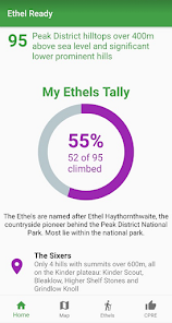
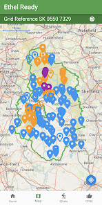
Are your ready for the challenge of climbing all of the Peak District's Ethels? Named after Ethel Haythornthwaite (the pioneer behind the Peak District National Park), the Ethels are all of the Peak District hills over 400m above sea level and significant lower prominent hills. Fewer, lower, easier and (for most of the UK's population) closer than the Munros of Scotland and the Wainwrights of the Lake District.
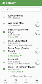
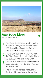
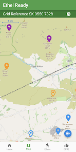
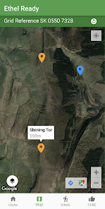
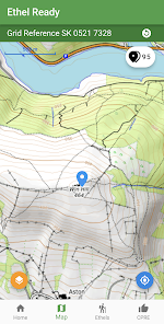
Explore the highest hills of the Peak District. Track your progress through your own dated log and by using the interactive map from OpenStreetMap.
Featured on BBC TV and Radio 4
© Doug Colton. The Ethels and the Ethel Ready app are the original work of Doug Colton.
Base map and data from OpenStreetMap and OpenStreetMap Foundation
© OpenStreetMap contributors.
All images are subject to copyright © 2022 Doug Colton (or are used through Creative Commons Licence).
Oxirgi yangilanish
Xavfsizlik — dastur ishlab chiquvchilar maʼlumotlaringizni qanday jamlashi va ulashishini tushinishdan boshlanadi. Maʼlumotlar maxfiyligi va xavfsizlik amaliyotlari ilovadan foydalanish, hudud va yoshga qarab farq qilishi mumkin. Bu axborot dastur ishlab chiquvchi tomonidan taqdim etilgan va keyinchalik yangilanishi mumkin.


Nima yangiliklar
Updated details for Sponds Hill


