Smartarea
Contains ads
4.3star
752 reviews
100K+
Downloads

Everyone
info
About this app
What is Smartarea?
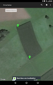
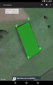
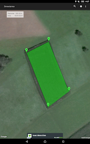
With Smartarea you can measure areas and distances on the quick.
It’s the perfect tool for your field work, construction, calculation of roof areas, sports and a lot more.
How does Smartarea work?
Smartarea is using your mobile phone’s GPS signal for all calculations. After the installation you can immediately measure for instance your property.
Functions of Smartarea:
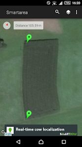
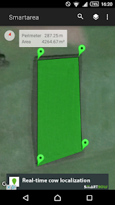
Measurement of areas and distances via Google Maps
You can set, adapt and delete measurement points by touching the display
You can search for your current position via GPS or network and add your location as a measurement point
The view scales and centers automatically
You can choose between different measurement units
Possibility to change between map- and satellite view
Export your measured areas into Google Earth or Google Maps (KML-file)
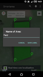
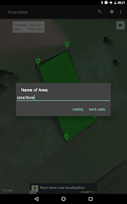
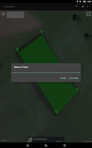
Name your areas and send your data as image (.png) or KML-file via e-mail
With Smartarea you can measure areas and distances on the quick.
It’s the perfect tool for your field work, construction, calculation of roof areas, sports and a lot more.
How does Smartarea work?
Smartarea is using your mobile phone’s GPS signal for all calculations. After the installation you can immediately measure for instance your property.
Functions of Smartarea:
Measurement of areas and distances via Google Maps
You can set, adapt and delete measurement points by touching the display
You can search for your current position via GPS or network and add your location as a measurement point
The view scales and centers automatically
You can choose between different measurement units
Possibility to change between map- and satellite view
Export your measured areas into Google Earth or Google Maps (KML-file)
Name your areas and send your data as image (.png) or KML-file via e-mail
Updated on
Safety starts with understanding how developers collect and share your data. Data privacy and security practices may vary based on your use, region, and age. The developer provided this information and may update it over time.


