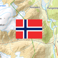
Norway Topo Maps
Contains adsIn-app purchases
4.2star
792 reviews

Everyone
info
50K+
Downloads


About this app
Turn your Android phone or tablet into a powerful offline GPS navigation system for Norway. Perfect for hiking, cycling, and outdoor activities in areas without mobile coverage.
Explore detailed topographic maps, aerial imagery, nautical charts and satellite maps with advanced navigation tools – similar to professional GPS devices.
Access high-quality maps for Norway and worldwide:
• Norway Topographic Maps from Kartverket
• Norway Nautical Charts from Kartverket
• Norway Historical Maps from Kartverket
• 1:50,000 Topographic Maps for Scandinavia (Norway, Sweden, Finland, Denmark)
• AtloMaps OSM Maps with hillshading (worldwide)
• CyclOSM maps for cycling routes
• ESRI Topographic, Aerial, and Street Maps (online only)
• Google Maps and Satellite (online only)
• Bing Maps and Satellite (online only)
• Earth at Night
Outdoor GPS Navigation Features
Reliable navigation tools for outdoor use:
• Record GPS tracks (distance, speed, elevation, accuracy)
• Trip computer with customizable data fields
• Create and manage waypoints
• Navigate directly to waypoints
• Measure distances and areas
• Compare maps with a transparency slider
• Search for places, addresses, and POIs
• Display coordinates in Lat/Lon, UTM, or MGRS/USNG
• Rotate map (North Up / Track Up)
• Tap map for elevation and distance
• Track replay
• Export and share data (GPX, KML, KMZ)
Map Overlays (Free)
Enhance maps with additional layers:
• Hiking, cycling, MTB, and winter sports routes worldwide
• Norway trekking, bicycle, and cross-country skiing routes
• Avalanche steepness
• Cadastre
• Placenames
• 10 m contour lines worldwide
• Hillshade overlay worldwide
• OpenSeaMap
Pro Features (In-App Purchase):
Unlock advanced offline navigation:
• Full offline GPS navigation without mobile signal
• Bulk download of maps
• Route navigation (hiking & cycling profiles)
• Create and edit routes
• Import GPX, KML, KMZ files
• Unlimited waypoints and tracks
• Add custom map sources (WMS & raster maps)
• Ad-free experience
Offline Maps and Navigation
All viewed map tiles are cached automatically.
Download larger areas in advance and use the app fully offline – no roaming costs.
Outdoor Activities
Ideal for hiking, cycling, MTB, camping, skiing, climbing, canoeing, aviation, hunting, off-road navigation, and search & rescue (SAR).
GPS Data and Formats
Supports coordinates in Lat/Lon, UTM, and MGRS/USNG (WGS84).
Import, export, and share GPS data in GPX or KML/KMZ.
Privacy
No tracking. No data collection.
Your location data stays on your device.
Support
support@atlogis.com
More apps:
https://play.google.com/store/apps/developer?id=ATLOGIS+Geoinformatics+GmbH+%26+Co.+KG
Updated on
Safety starts with understanding how developers collect and share your data. Data privacy and security practices may vary based on your use, region, and age. The developer provided this information and may update it over time.

This app may share these data types with third parties
Personal info, App activity and 2 others

No data collected
Learn more about how developers declare collection

Data is encrypted in transit

You can request that data be deleted
Ratings and reviews
4.0
716 reviews

ed hitchcock
- Flag inappropriate
- Show review history
February 23, 2026
I use and like the NZ version. like s reviewer here I would like a permanent option to always as in always have North up. The permanent option that exists still allows the map to rotate, easily done by accident.
ATLOGIS Geoinformatics GmbH & Co. KG
February 23, 2026
With klick on compass rose the map turns north up. In preferences/map/map orientation = north up you can set it permanentely.

Dara Jon
- Flag inappropriate
August 6, 2025
Great maps and has a real-time location tracking, making it extremely easy to see if you've wandered off track. App is intuitive to use, and works great in the free state. If you do want to support the app, press the 'go pro' tab in the settings (this is not a camera setting).
1 person found this review helpful

Linguistic Learning Study With Me
- Flag inappropriate
December 5, 2023
USERS BEWARE – Data Safety – How can this app claim to collect no data, yet list out the data this app shares with third parties? Did I just install the app, to write this, then uninstall it? Yes! For I did not find out how to report this app to Google, for false/misleading information. If the developer replies, please do also mention how this can be done (if needed in the future, with others).
3 people found this review helpful
ATLOGIS Geoinformatics GmbH & Co. KG
December 5, 2023
Dear User. The app itself does not collect user data but the admob third party library does when ads are shown in the free version. You can adjust the behavior of this third party library in the settings by going to 'Preferences' -> 'Data protecttion' -> 'Personalized Advertizing'. Kind regards, Andreas
What’s new
・New Overlay 'Bratthet Snoskred'
・Fixes
・Fixes
App support
About the developer
Atlogis Geoinformatics GmbH & Co. KG
support@atlogis.com
Unter den Ulmen 8
33330 Gütersloh
Germany
+49 5241 4032281


