
CultivateAI Scouting
10+
Downloads

Everyone
info


About this app
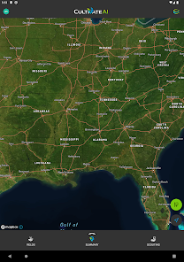
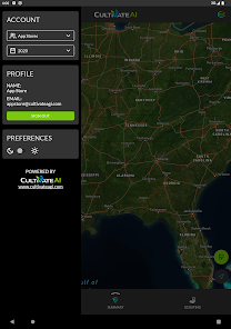
Visualize asset locations and field boundary data anytime, anywhere - in the web based software in the office or on a mobile device in the field. Create new scouting locations and upload them to your Ag Organization’s cloud storage.
App Features Include:
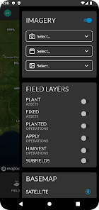
- Displays your Ag Organization field boundaries, asset locations and scouting observations on an interactive map.
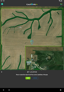
- Create new scouting observation locations and details.
- View planted and fixed asset locations and edit details.
- Display imagery collection events on the map.
- User Interface display in dark or light mode.
- Based on permissions, the user is able to switch and view data from multiple Agronomic organizations
App Features Include:
- Displays your Ag Organization field boundaries, asset locations and scouting observations on an interactive map.
- Create new scouting observation locations and details.
- View planted and fixed asset locations and edit details.
- Display imagery collection events on the map.
- User Interface display in dark or light mode.
- Based on permissions, the user is able to switch and view data from multiple Agronomic organizations
Updated on
Safety starts with understanding how developers collect and share your data. Data privacy and security practices may vary based on your use, region, and age. The developer provided this information and may update it over time.

No data shared with third parties
Learn more about how developers declare sharing

This app may collect these data types
Personal info

Data is encrypted in transit

Data can’t be deleted
What's new
Remove field id and notes panel from field details view
Enlarge driving directions icon
Enlarge driving directions icon


