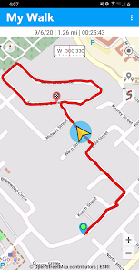
Use Trailblazer Navigator Pro to display tracks and waypoints in KML and KMZ files, then navigate them with the app's offline and online maps. Download a map before traveling beyond network reach and use it to keep you oriented anywhere on the planet! Record your hikes, runs and bike rides with the app's track recorder and create waypoints with the app's location logging tools.
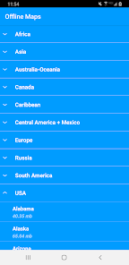
Maps Trailblazer Navigator Pro has maps for every situation. Explore mountains and national parks with topographic and hiking maps. Find and explore biking trails with our cycle maps and navigate coastal areas with NOAA nautical charts. Our offline maps are perfect for back country hiking and cycling. Offline maps can be downloaded and transferred to the SD card to save phone memory.
In keeping with our company's pledge to make our downloadable maps available to the most number of people, all maps are available free without any limits on downloads.
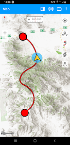
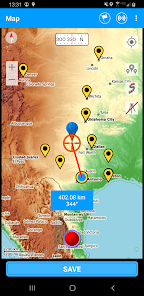
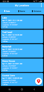
View your previously recorded trails and waypoints on any map or add trails and waypoints from a kml or kmz file. All maps have custom built-in compasses and measurement tools to enhance your location awareness.
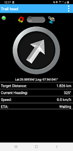
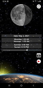
Location Recorder Save your current location, enter coordinates or use a map to create a waypoint. Multiple coordinate formats including UTM can be entered. Navigate to any saved location using maps or the app's location-finding compass where you simply follow the arrow along a straight line course to your waypoint.
Trail Navigation Record a track and follow it on your return trip or navigate along a trail included on the maps.
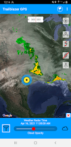
Weather Maps • Animated Live Doppler Weather Radar. • Weather Satellite Layer (visible clouds and infrared imaging).
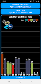
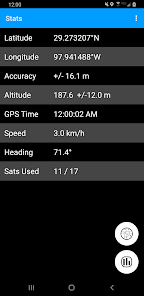
GPS Parameters and GPS Signal Diagnostics Navigation accuracy is only as good as the information that comes from your GPS chip. Use the app's GPS reports to understand the accuracy of your location information and the quality of the GPS signals received by your phone. For our more technically oriented users, the app offers graphs and charts that describe GPS signal quality and satellite location in greater detail.
Compasses Magnetic compasses, GPS controlled compasses and waypoint compasses are all there to give you that extra bit of navigation information that cannot be provided by a map alone. All magnetic compasses feature gyroscopic stabilization on compatible devices for super smooth operation.
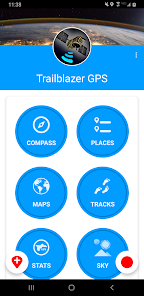
Explore the app and you will be surprised by the number of useful navigation tools that are available!
Updated on
Feb 13, 2022
Maps & Navigation
Data safety
arrow_forward
Safety starts with understanding how developers collect and share your data. Data privacy and security practices may vary based on your use, region, and age. The developer provided this information and may update it over time.
This app may share these data types with third parties
Location, App activity, and App info and performance
This app may collect these data types
Device or other IDs
Data is encrypted in transit
Data can’t be deleted
See details
'> -->
Not Found
We're sorry, the requested URL was not found on this server.