* Draw any free-form closed shape on a map or point-plot a perimeter to get the enclosed area. Great if you just want to know the area of your neighbor's back yard or the area and perimeter of the continental U.S. Useful for construction planning, gardening, or any other task that requires area measurements.
* Plot 2 points on a map and get the altitudes, distance and altitude difference between them along with reverse geocoded locality information.
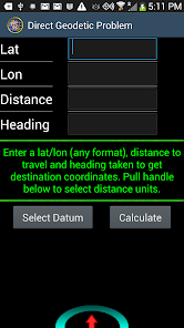
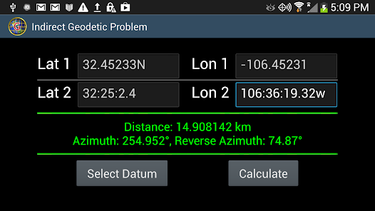
* Solutions for the direct and indirect geodetic problem.
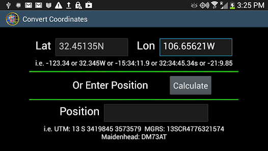
* Lots of screens for making distance, area, heading and altitude calculations including, for the technically minded, a geodetic problem calculator for inverse and direct geodetic problems. Choose your geoid (DATUM).
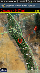
* Distance from your position to any position on the globe.
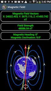
* Magnetic field tools including A COMPASS with a magnetic declination indicator.
* Time measurements.
* Excellent documentation with easy to follow help.
Updated on
Mar 7, 2024
Tools
Data safety
arrow_forward
Safety starts with understanding how developers collect and share your data. Data privacy and security practices may vary based on your use, region, and age. The developer provided this information and may update it over time.
This app may share these data types with third parties
Location, App activity and 2 others
No data collected
Learn more about how developers declare collection
Data is encrypted in transit
Data can’t be deleted
See details
'> -->
Not Found
We're sorry, the requested URL was not found on this server.