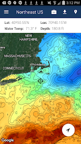
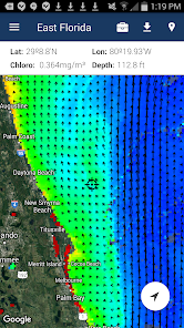
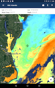
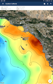
FishTrack provides saltwater anglers with everything they need to find fish. The FishTrack app offers free cloudfree sea surface temperature (SST) charts, global satellite imagery and marine weather forecasts – all in one layered tool.
With FishTrack you can:
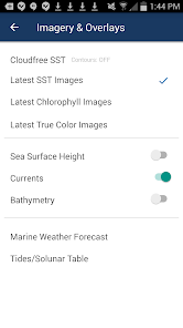
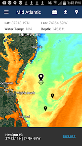
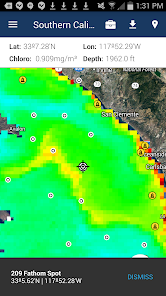
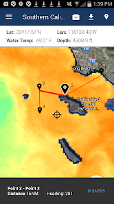
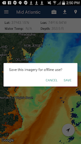
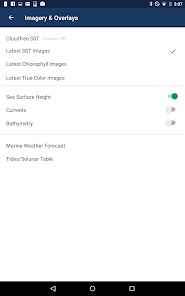
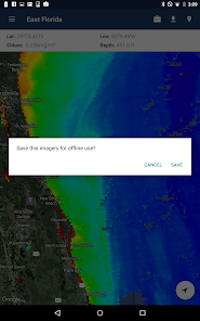
- View the latest SST, chlorophyll and true color satellite imagery - Overlay bathymetry, ocean currents and sea surface height - Save waypoints to mark fishing spots and catches - Create routes to plan a trip and view distances and headings - View marine weather forecasts and tides/solunar tables - Save fishing chart imagery for offline use - View your current location both online and offline
Don't fish blind! FishTrack helps you plan a productive trip offshore. Burn less fuel and find fish faster.
We want to hear from you! Submit your questions or comments through our app to let us know what you think. If you'd like to speak directly with our customer service team, please e-mail us at: support@fishtrack.com.
Updated on
Jan 10, 2024
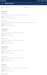
Weather
Data safety
arrow_forward
Safety starts with understanding how developers collect and share your data. Data privacy and security practices may vary based on your use, region, and age. The developer provided this information and may update it over time.
This app may share these data types with third parties
Location, Personal info and 3 others
This app may collect these data types
Location, Personal info and 3 others
Data is encrypted in transit
You can request that data be deleted
See details
'> -->
Not Found
We're sorry, the requested URL was not found on this server.