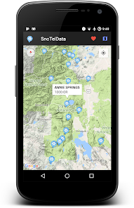
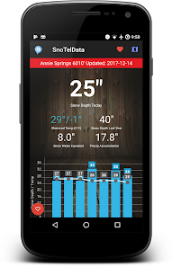
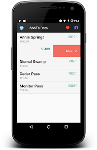
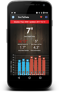
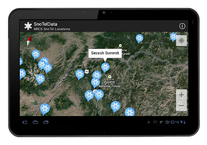
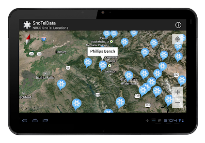
The SnoTel and SnoLite app is an ideal tool for backcountry skiers and anyone interested in snowfall and weather conditions across the United States. It maps the locations of over 700 SnoTel and SnoLite stations, which collect snow and climate data, providing timely information on observed temperature, precipitation, snow depth, and snow water equivalent for each station. Additionally, the app displays graphs of snow depth and temperature, allowing users to analyze trends over time. Users can save favorite stations. The app also provides a beta avalanche danger level map to assess the risk of avalanches in different areas. All data is sourced from the National Resource Conservation Service (NRCS), and historical data is also available. The app is user-friendly, easy to navigate, and an essential tool for backcountry skiing and snow enthusiasts.
New Releases are in TESTING >>> Please check out the Open BETA! Help develop this app.
Updated on
Feb 28, 2024
Weather
Data safety
arrow_forward
Safety starts with understanding how developers collect and share your data. Data privacy and security practices may vary based on your use, region, and age. The developer provided this information and may update it over time.