If you want to see other country, please select OpenStreetMap at Menu -> Map Manage ->Map Mode
We use the tile according to the rules of Geospatial Information Authority of Japan.
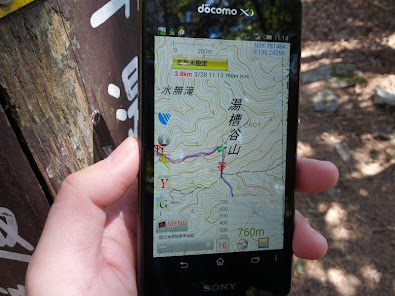
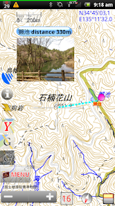
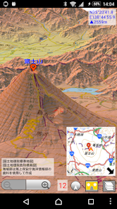
Functions -Topographical map (Japan only. Tile of Geospatial Information Authority of Japan.) -OpenStreetMap -Web map tile -GPS location search -Bookmark (You can record POI) -Distance measurement -Route creation (route of straight line, route) -Import GPX file (Please send GPX file from file manager application)
Icons by Orion Icon Library - https://orioniconlibrary.com
Smart Connect extension for SmartWatch 2
Updated on
Apr 14, 2024
Travel & Local
Data safety
arrow_forward
Safety starts with understanding how developers collect and share your data. Data privacy and security practices may vary based on your use, region, and age. The developer provided this information and may update it over time.