TrekMe - GPS trekking offline
Kupovina unutar aplikacije
3,9star
632 recenzije
100 hilj.+
Preuzimanja

Svako
info

O aplikaciji
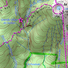
TrekMe is an Android app to get live position on a map and other useful information, without ever needing an internet connection (except when creating a map). It's ideal for trekking, biking, or any outdoor activity.
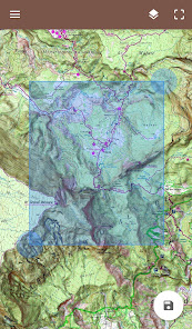
In this application, you create a map by chosing the area you want to download. Then, your map is available for offline usage (the GPS works even without mobile data).
Download from USGS, OpenStreetMap, SwissTopo, IGN (France and Spain)
Other topographic map sources will be added.
Fluid and doesn't drain the battery
Particular attention was given to efficency, low battery usage, and smooth experience.
SD card compatible
A large map can be quite heavy and may not fit into your internal memory. If you have an SD card, you can use it.
Features
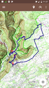
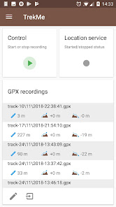
• Import, record, and share GPX files
• Marker support, with optional comments
• Real-time visualization of a GPX record, as well as its statistics (distance, elevation, ..)
• Orientation, distance, and speed indicators
• Measure a distance along a track
• Be alerted when you move away from a track
For instance, all map providers are free, except for France IGN - which requires an annual subscription.
For professionals and enthousiasts
If you have an external GPS with bluetooth*, you can connect it to TrekMe and use it instead of the internal GPS of your device. This is especially useful when your activity (aeronautic, professional topography, ..) requires better precision and updating your position at a higher frequency than every second.
(*) Supports NMEA over bluetooth
Privacy
During a GPX recording, the app collects location data even when the app is closed or not in use. However, your location will never be shared with anyone and gpx files are stored locally on your device.
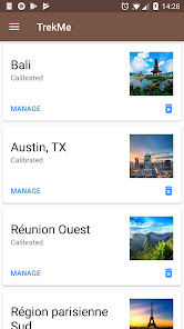
General TrekMe guide
https://github.com/peterLaurence/TrekMe/blob/master/Readme.md
In this application, you create a map by chosing the area you want to download. Then, your map is available for offline usage (the GPS works even without mobile data).
Download from USGS, OpenStreetMap, SwissTopo, IGN (France and Spain)
Other topographic map sources will be added.
Fluid and doesn't drain the battery
Particular attention was given to efficency, low battery usage, and smooth experience.
SD card compatible
A large map can be quite heavy and may not fit into your internal memory. If you have an SD card, you can use it.
Features
• Import, record, and share GPX files
• Marker support, with optional comments
• Real-time visualization of a GPX record, as well as its statistics (distance, elevation, ..)
• Orientation, distance, and speed indicators
• Measure a distance along a track
• Be alerted when you move away from a track
For instance, all map providers are free, except for France IGN - which requires an annual subscription.
For professionals and enthousiasts
If you have an external GPS with bluetooth*, you can connect it to TrekMe and use it instead of the internal GPS of your device. This is especially useful when your activity (aeronautic, professional topography, ..) requires better precision and updating your position at a higher frequency than every second.
(*) Supports NMEA over bluetooth
Privacy
During a GPX recording, the app collects location data even when the app is closed or not in use. However, your location will never be shared with anyone and gpx files are stored locally on your device.
General TrekMe guide
https://github.com/peterLaurence/TrekMe/blob/master/Readme.md
Ažurirano dana
Sigurnost počinje razumijevanjem na koji način programeri prikupljaju i dijele vaše podatke. Privatnost podataka i sigurnosne prakse se mogu razlikovati ovisno o korištenju, regiji i dobi. Programer je pružio ove informacije i može ih s vremenom ažurirati.

Podaci se ne dijele s trećim stranama
Saznajte više o načinu na koji programeri pružaju izjavu o dijeljenju

Podaci se ne prikupljaju
Saznajte više o načinu na koji programeri pružaju izjavu o prikupljanju
Ocjene i recenzije
3,9
607 recenzija

Mehidin Dulovic
- Označavanje kao neprikladno
28. februar 2024.
Mehibin.dulviv
Šta ima novo
4.1.0
• Automatically zoom on current position when creating a map (if possible)
4.0.10, .., 4.0.0
• Minor fixes
• Refreshed design
• New: change color of markers
• Maps created from this release can now be repaired by downloading missing tiles (if any), or updated by re-downloading all the content.
This can be done from the settings of a map.


