Topographical charts Holland
In-app purchases
10K+
Downloads

Everyone
info


About this app
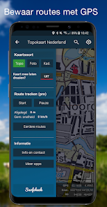
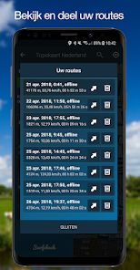
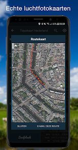
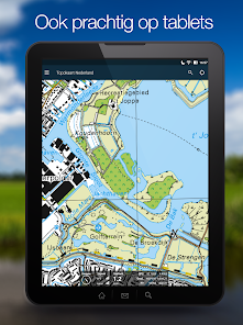
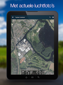
This app is mainly aimed for use in the Netherlands, and contains unique topographical maps, aerial photography maps and the current maps used and published by the Dutch land registry office. Live from the governmental systems. Data that is best in class.
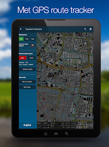
Please do mind: the app also contains an excellent and very stable GPS tracker - available as a pro feature - and features Open Street Map maps for all the countries outside the Netherlands. The interface language though, is in Dutch.
Disclaimer
We do our utmost to deliver you the best software and data available in the market, but of course we cannot guarantee the proper functioning or accuracy of both. Data sources can change over time. You can not derive rights from this information. By downloading and using this app you accept these terms.
Location
The location permission is necessary to enable the app to show you your current position. It is not used nor stored for anything else at all.
Updated on
Safety starts with understanding how developers collect and share your data. Data privacy and security practices may vary based on your use, region, and age. The developer provided this information and may update it over time.

No data shared with third parties
Learn more about how developers declare sharing

No data collected
Learn more about how developers declare collection

Data is encrypted in transit

Data can’t be deleted
What's new
V3.3 - A few bugfixes and modernizations of the app code.
App support
phone
Phone number
+31627511277


