BenchMap
Ilova ichida xaridlar
4,3star
164 ta sharh
10 ming+
Yuklanmalar

Hamma uchun
info


Bu ilova haqida
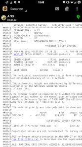
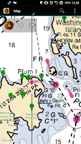
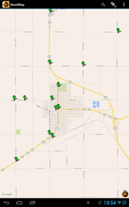
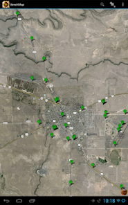
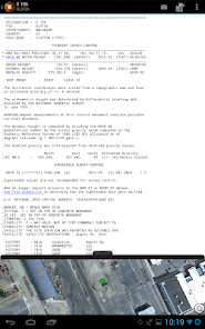
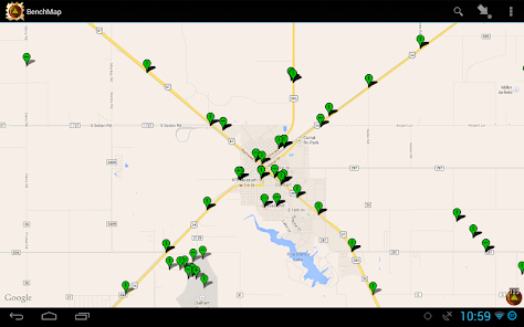
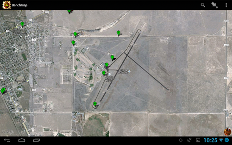
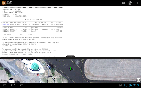
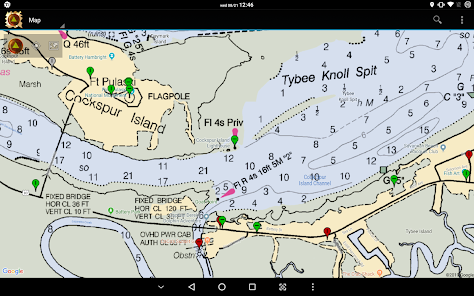
BenchMap allows searching and viewing of National Geodetic Survey (NGS) survey stations on an interactive map. The map will allow you to quickly determine if the control station is usable, and whether the chances that it still exists. Once a station is selected, you can view its datasheet - both in the app and through your web browser. You can also pull up the Geocaching page, in case there may be useful notes that aren't on the NGS's site.
Tools for submitting a recovery to the NGS inslude allowing you to take pictures of the station (using the recommended naming format), and record notes. (At this time, submission of recoveries is not possible in the app - but may be available in the future!)
Filtering allows you view just the types of stations to display that you want - like certain stabilities, horizontal/vertical orders, and destroyed/non-publishable status. You can also directly search for a PID and have the map take you to the location of the station.
Made for the professional surveyor and the hobbyist out there in the wild.
Note that the application will only display NGS survey marks. At this time, certain agencies' stations will not appear in the app, unless their survey controls were submitted to the NGS. These agencies include:
- United States Geological Survey (USGS) - they will never digitize their station database.
- Army Corps of Engineers (ACE) - they have an online database, but at this time no API to pull data from.
- Department of Interior (DOI) - Stations for the DOI that don't fall under the ones above at this time have no API.
If any of these open up an API to pull survey marks from, they will be included.
Oxirgi yangilanish
Xavfsizlik — dastur ishlab chiquvchilar maʼlumotlaringizni qanday jamlashi va ulashishini tushinishdan boshlanadi. Maʼlumotlar maxfiyligi va xavfsizlik amaliyotlari ilovadan foydalanish, hudud va yoshga qarab farq qilishi mumkin. Bu axborot dastur ishlab chiquvchi tomonidan taqdim etilgan va keyinchalik yangilanishi mumkin.


Reytinglar va sharhlar
4,3
161 ta sharh
Nima yangiliklar
Includes small fixes:
- Less battery usage when app is not in foreground.
- Fix to some user's 'My Location' dot not showing up.
- Adds bearing arrow to dot when moving.
- Updated linked libraries.
- Less battery usage when app is not in foreground.
- Fix to some user's 'My Location' dot not showing up.
- Adds bearing arrow to dot when moving.
- Updated linked libraries.


