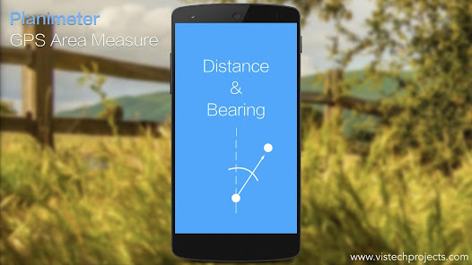
Planimeter is the best land surveying app and field area measurement tool.
With the free version, you can start measuring right away by simply touching the map. But for a comprehensive toolkit, unlock all features with a subscription.
Unlock features like:
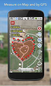
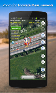
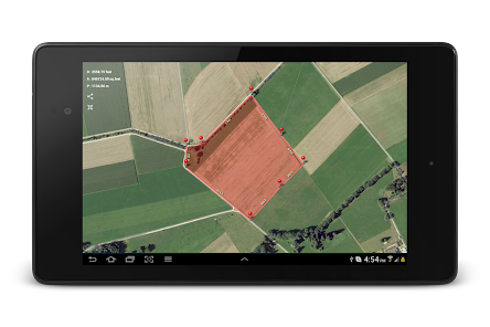
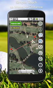
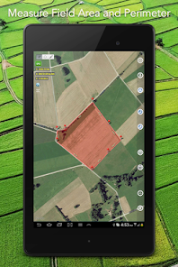
- measure distance, perimeter, bearing, angle, and GPS coordinates in various formats directly on the map.
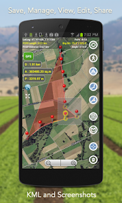
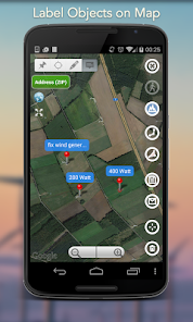
- save, edit, label, view, and share your measurements as KML data files and screenshots.
- live measurement using GPS tracking (walk/drive around) with time interval and accuracy settings;
- achieve pinpoint precision with a magnifying glass for accurate pin placement: https://youtu.be/Hha_nmC032M
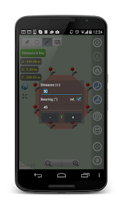
- add points with exact distance and angle input for precise measurements. (Distance and Bearing Feature): http://goo.gl/8XbhJU
Other exclusive features include:
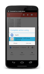
- creating, sharing, and viewing KML files: http://goo.gl/2cdI8w
- Intuitive label addition in Notes Mode: http://goo.gl/s52VdU
- quick access to directions and navigation from Notes Mode: http://goo.gl/nCRTQi
- smart tools for removing redundant points and generating convex areas.
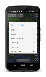
- support for various geo-coordinate formats
- quick switch and view measured paths and polygons in the Google Earth app
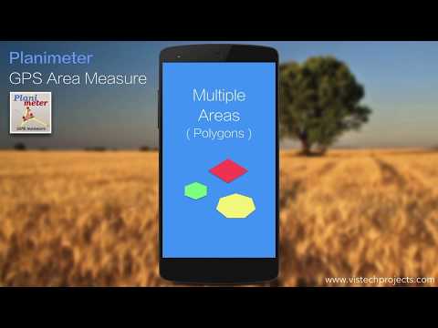
- multiple areas measurements: https://goo.gl/SrFMj3
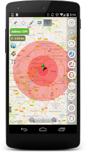
- circle Mode - radius around point: https://goo.gl/dkHuvy
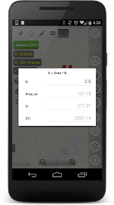
- volume/cost calculator when height or rate per area unit entered https://goo.gl/dkHuvy
Languages: English, Portuguese, Russian, German, Italian
Join thousands of satisfied users who've applied Planimeter in diverse scenarios:
- outdoor activities: golf (distance between two points or holes), bike and hike trail planning, quick path measure or mapping a run
- garden and yard: landscape planning, grass cutting, lawn care and mowing, fencing, grass seeding.
- agriculture and farming: harvesting, fertilizing, crop planning, and estimation, field labeling, field area measure, paddocks, and area fencing,
- solar energy: solar panels placement estimation, flat roof area estimation
- construction: land and site survey, road sealing, parking lot repair, pole lines planning
- forestry: objects and tree mapping, damage area estimation, measuring land area
- insurance: crop adjuster tool, verify data and support claims
- property: check location context by measuring distances to nearby schools, parks, police stations, and shopping centers.
- other: fence calculation, geocaching, quick estimation, and quotes for land-related work
More about the app, tips, and updates: https://vistechprojects.blogspot.com/search/label/Planimeter