(!) IMPORTANT: THIS IS A GUIDE for popular "Planimeter - GPS Area Measure" app (https://goo.gl/Yp0NLv).
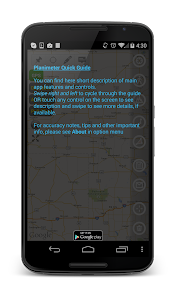
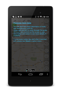
From this guide you can learn about Planimeter interface, functionality and main features before purchasing Planimeter. You can touch interface elements to get more details about their purpose and functionality. Don't hesitate to contact support@vistechprojects.com with any questions or if you need further assistance with Planimeter.
This guide presented in English, Russian, Portuguese and German.
Info about the Planimeeter app:
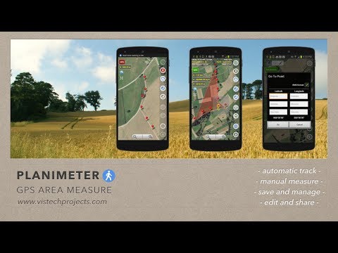
"Planimeter - GPS Area Measure" - Android application for all kinds of measurements on Google Maps.
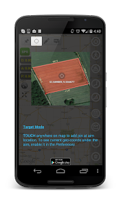
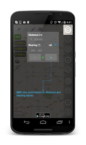
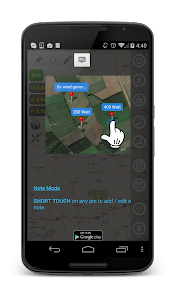
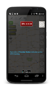
It allows you to perform quick area, distance, perimeter and angle measurements on maps using different input sources. You can perform measurement by touching the screen; adding way-points with geo-coordinates (latitude and longitude); drawing on the map; using GPS tracking; dropping pins with exact distance and bearing from the last point.
The Planimeter app can be used in many areas and applications where measurement on land are required:
- outdoor activities: sports, golf (distance between two points or holes), bike tours, trail planning, travelling, quick measure
- garden and yard: landscape planning, grass cutting, lawn mowing, fencing, grass seeding.
- agriculture and farming: harvesting, fertilizing, crops (corn, wheat, maize, beet, etc.) planning and estimation, crop fields labeling for the records, field area measure, paddocks and area fencing for cows, horses, chickens, rabbits, etc.
- solar energy: area estimation for solar panels, flat roof area estimation
- construction: land survey, road sealing, parking lot repairing
- forestry: objects and tree mapping, damage area estimation
- other: ponds size and are measure; pole lines planning; directions and navigation to the marked / shared point; movement tracking; get exact GPS coordinates of way-points; fence calculation; measure distance on google maps
You can buy Planimeter - GPS Area Measure and read users feedback here: https://goo.gl/Yp0NLv
More about Planimeter - GPS Area Measure, tips and updates: http://goo.gl/IPF0NI