NavShip - Waterway Routing
Reklamalar mavjudIlova ichida xaridlar
4,1star
2,17 ming ta sharh
500 ming+
Yuklanmalar

Hamma uchun
info


Bu ilova haqida
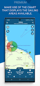
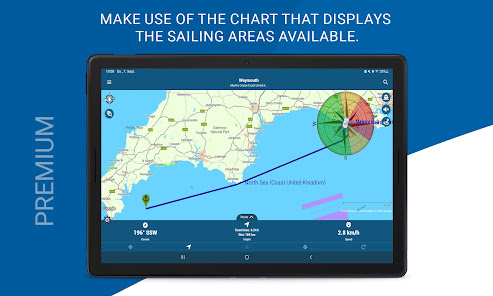
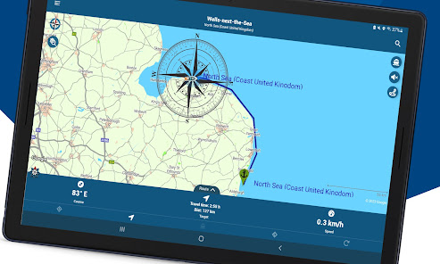
Best for inland waterway routing! Please note, that some rivers and seas might not be included yet. Please use the contact form inside the app menu (report error at the bottom) to request a new waterway, and we will implement them as soon as possible.
Free version: Up to 40 km (25 miles) route planning and 8 km tracking. We use advertisement in free version. Unfortunately, this app does not contain water depths.
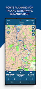
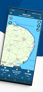
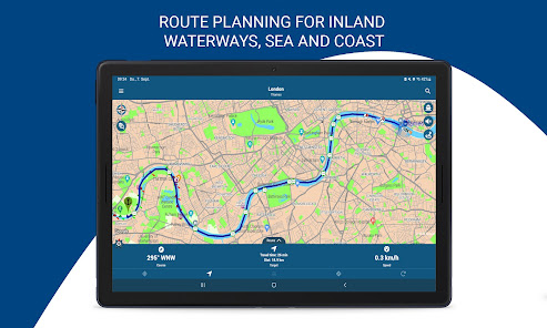
NavShip is a free navigation assistance software for nautic usage in Europe, Canada and the United States. It uses an special overlay for google maps or open sea map to show shipping signs and contains by now more than 250.000 waterways.
No problem to get from A to B, even if there's an ocean between you and your target. London - Rome, Paris - Amsterdam, Copenhagen - Stockholm, Frankfurt - Istanbul, Chicago - Toronto, nearly every route can be calculated.
NavShip needs access to device's storage to work properly. It never accesses your private data or contacts.
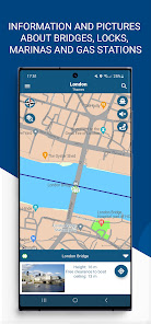
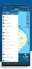
Wear OS: NavShip provides a Wear OS App for Smartwatches. You can easily connect with live routing on your app, please enable this functionality in side menu at "settings" and "Wear OS support". Calculate a route on your smartphone and view your current speed, course offset, distance and travel time via smartwatch. Even the next bridge or lock will be displayed.
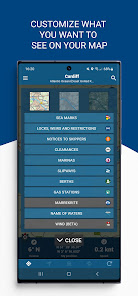
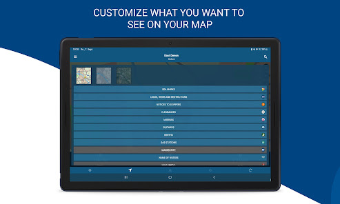
Features:
Offline-Routing
Live-Routing
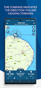
Kilometres or miles, km/h or knots
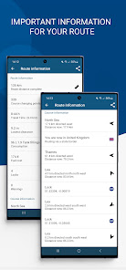
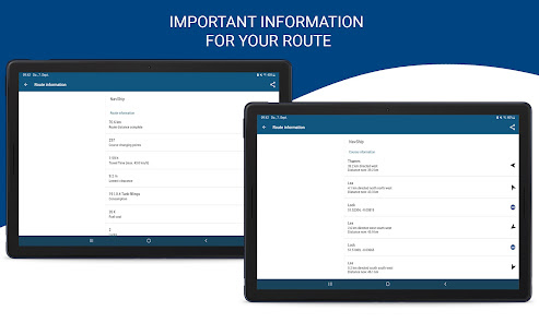
Travel time and distance
Approx. arrival time
Course and speed over ground
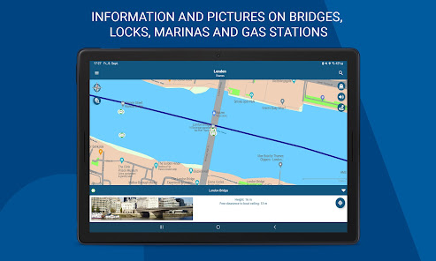
Locks
Fuel and costs
Anchor alert
Implementation of own boat icon for routing
Lots of more...
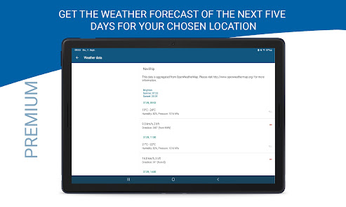
Get more information at www.navship.org
Disclaimer: This app should only be used as an assistant. Please use it carefully and supportive. NavShip is not responsible for accidents. Please note the in app disclaimer and the terms of use at navship.org.
Free version: Up to 40 km (25 miles) route planning and 8 km tracking. We use advertisement in free version. Unfortunately, this app does not contain water depths.
NavShip is a free navigation assistance software for nautic usage in Europe, Canada and the United States. It uses an special overlay for google maps or open sea map to show shipping signs and contains by now more than 250.000 waterways.
No problem to get from A to B, even if there's an ocean between you and your target. London - Rome, Paris - Amsterdam, Copenhagen - Stockholm, Frankfurt - Istanbul, Chicago - Toronto, nearly every route can be calculated.
NavShip needs access to device's storage to work properly. It never accesses your private data or contacts.
Wear OS: NavShip provides a Wear OS App for Smartwatches. You can easily connect with live routing on your app, please enable this functionality in side menu at "settings" and "Wear OS support". Calculate a route on your smartphone and view your current speed, course offset, distance and travel time via smartwatch. Even the next bridge or lock will be displayed.
Features:
Offline-Routing
Live-Routing
Kilometres or miles, km/h or knots
Travel time and distance
Approx. arrival time
Course and speed over ground
Locks
Fuel and costs
Anchor alert
Implementation of own boat icon for routing
Lots of more...
Get more information at www.navship.org
Disclaimer: This app should only be used as an assistant. Please use it carefully and supportive. NavShip is not responsible for accidents. Please note the in app disclaimer and the terms of use at navship.org.
Oxirgi yangilanish
Xavfsizlik — dastur ishlab chiquvchilar maʼlumotlaringizni qanday jamlashi va ulashishini tushinishdan boshlanadi. Maʼlumotlar maxfiyligi va xavfsizlik amaliyotlari ilovadan foydalanish, hudud va yoshga qarab farq qilishi mumkin. Bu axborot dastur ishlab chiquvchi tomonidan taqdim etilgan va keyinchalik yangilanishi mumkin.

Tashqi hamkorlarga hech qanday axborot ulashilmagan
Dastur ishlab chiquvchilar axborot ulashilishini qanday aytishi haqida batafsil

Ushbu ilova quyidagi axborot turlarini toʻplashi mumkin
Ilova axboroti va unumdorlik

Maʼlumotlar uzatish vaqtida shifrlanadi

Maʼlumotlarni oʻchirishni soʻrashingiz mumkin
Reytinglar va sharhlar
4,2
1,84 ming ta sharh
Nima yangiliklar
HD seamark layer added
Voice output improved
Improved menu design
New route management system
Sharing routes via link to others
Voice output improved
Improved menu design
New route management system
Sharing routes via link to others


