You can tap between two points on the map to measure a straight line distance, or use a circle that can be resized to get a sense of distance .
■ As a disaster prevention measure
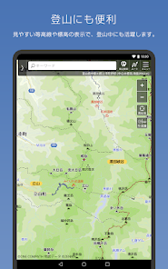
You can see the "above sea level (elevation)" of the current location and the point where the map is displayed for the whole country.
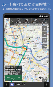
■ Map code indispensable for car navigation
The map code (*) is very convenient for setting the destination of the car navigation system. Tap and hold the map on the Mapion app and tap the address to display the map code.
■ The boundaries are interesting
The "boundary line" of cities, wards, towns and villages and large letters and town chomes is clearly drawn. Check the boundary with the neighboring town and train your sense of land.
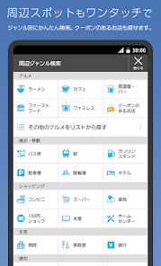
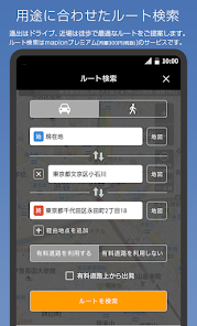
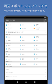
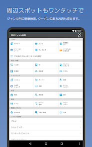
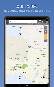
■ I want to move comfortably! We respond to such requests
We support you to move easily when you move on foot, such as "many roofs" and "fewer stairs".
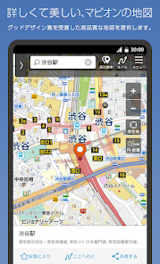
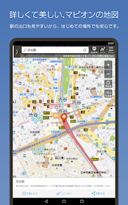
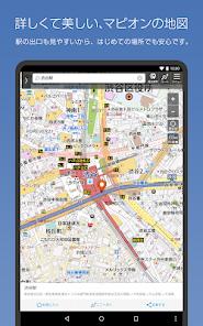
■ Beautiful graphics
Mapion won the Good Design Award as an easy-to-understand map.
While highlighting necessary information such as station exits, detailed information is also posted, and the color coding of each city in the administrative world (city, ward, town, village, town Oaza, chome) and beautiful graphics like a paper map are applied. You can experience it at.
You can switch to a vector-based map, which also supports rotation and bird views. Bird view mode is a 3D representation at fine scale.
By remembering the "color" of roads and buildings, it becomes easier to understand the characteristics of the city, such as what kind of facilities are in what area, or what kind of city is the area where buildings of the same color are gathered. increase.
#road
Blue-purple ... highway Orange ... National highway Yellow: Major local roads such as prefectural roads White ... general road Ash ... Mountain trail, beast trail
#building
Blue-green ... Accommodation Orange ・ ・ ・ Commercial facility Purple ・ ・ ・ Leisure facility Tea ... school Red brown ... public facilities Red ... hospital Zhu ・ ・ ・ Station
■ Recommended terminal
Please use it on Android 5.1 or above. It may not work properly on some models.
■ Operating company
The "Mapion" and "Map Mapion" apps are services operated by ONE COMPATH Co., Ltd.
[Precautions]
This service uses the map function of Mapbox. Your location information will be sent anonymously and used to improve map functionality in accordance with the company's privacy policy. If you change your location information acquisition settings, " handling of personal information in the app You can opt out on the "About " page.
* "Mapcode" and "MAPCODE" are registered trademarks of DENSO CORPORATION.
Updated on
Jul 12, 2023
Maps & Navigation
Data safety
arrow_forward
Safety starts with understanding how developers collect and share your data. Data privacy and security practices may vary based on your use, region, and age. The developer provided this information and may update it over time.
This app may share these data types with third parties
Device or other IDs
This app may collect these data types
Personal info, App activity, and App info and performance
Data is encrypted in transit
You can request that data be deleted
See details
'> -->
Not Found
We're sorry, the requested URL was not found on this server.