
JaxReady
3.5star
168 reviews

Everyone
info
50K+
Downloads

Everyone
Learn more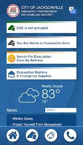


About this app
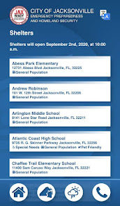
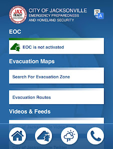
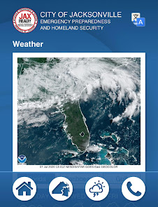
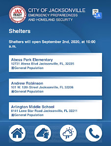
Are you ready? JaxReady— brought to you by the Emergency Preparedness Division and Information Technologies Division of the City of Jacksonville, Florida— will help you monitor weather threats and plan for evacuation in the event of a natural disaster. JaxReady provides access to current threat levels, weather reports, and wildfire updates, as well as up-to-the-minute news feeds for emergency preparedness and evacuation.
Features
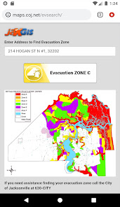
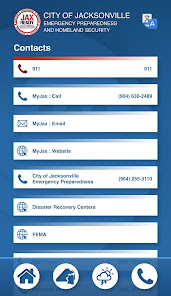
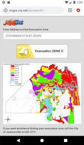
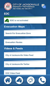
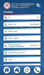
• GPS functionality for locating your Evacuation Zone
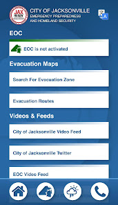
• Current Emergency (EOC) Activation Level, Weather Threat Level, and Fire Danger Index based upon your geolocation
• Links to special needs registration for those with special medical needs during an evacuation
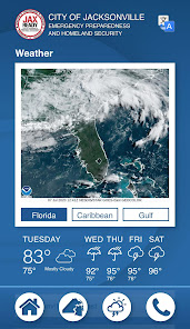
• Weather and fire news
• Weather, wildfire, and drought index maps
Features
• GPS functionality for locating your Evacuation Zone
• Current Emergency (EOC) Activation Level, Weather Threat Level, and Fire Danger Index based upon your geolocation
• Links to special needs registration for those with special medical needs during an evacuation
• Weather and fire news
• Weather, wildfire, and drought index maps
Updated on
Safety starts with understanding how developers collect and share your data. Data privacy and security practices may vary based on your use, region, and age. The developer provided this information and may update it over time.

No data shared with third parties
Learn more about how developers declare sharing

No data collected
Learn more about how developers declare collection

Data isn’t encrypted
Data can’t be deleted
Ratings and reviews
3.5
164 reviews

A Google user
- Flag inappropriate
- Show review history
October 5, 2018
I was apprehensive about installing this app based on past reviews. I contacted the city and they assured me it was working as intended. I did go ahead and install it. I was able to test most features to my satisfaction. I had no issues with the operation of the app or of my cell phone while using the app. The app does appear to function as intended. Due to there not being any current weather emergency I was NOT able to view an active list of available shelters. The radar does work but the satellite information did not. I don't know if this is a temporary or long term issue.
29 people found this review helpful

Jeremy Britton
- Flag inappropriate
September 29, 2022
Poorly optimized and in desperate need of maintenance (touch icons, loading times, scrolling issues & autofill function are a few I noticed off the bat). Amazing concept (I wish other states would adopt a similar system) and the body is there it just needs the TLC desperately.
3 people found this review helpful
A Google user
- Flag inappropriate
July 31, 2019
The latest update makes it work even faster! Useful for figuring out what zone I'm in plus the new weather maps are great.
5 people found this review helpful
What’s new
Updated to work with the newly updated JaxReady.com
Everyone
Learn moreApp support
About the developer
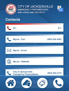
City of Jacksonville, Florida
MobileApps@coj.net
214 N Hogan St
Jacksonville, FL 32202-4240
United States
+1 904-255-8087


