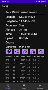
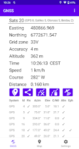
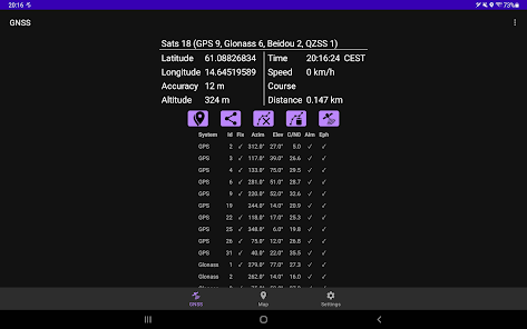
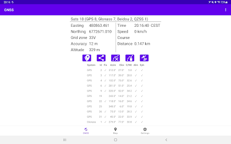
GNSS Viewer (Global Navigation Satellite System, ie, GPS, Glonass, Beidou, Galileo, IRNSS) displays current GNSS information as reported by the built-in GNSS unit of your phone (or tablet). The following GNSS data are displayed: - Position (latitude/longitude, UTM, or, SWEREF 99). - Accuracy (optional). - Altitude. - Speed or pace. - Course. - UTC or local time (optional). - Satellite data (optional).
The app calculates traveled distance as you walk/bicycle/drive/sail.
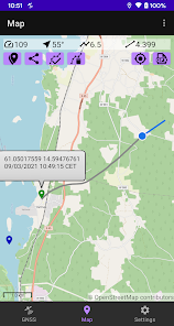
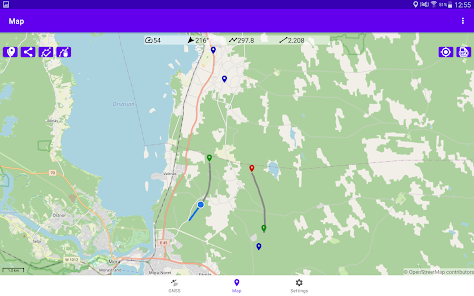
GNSS Viewer can log your position at user-defined intervals. The resulting track is displayed on a map and can be exported as a GPX/CSV file, for example via e-mail.
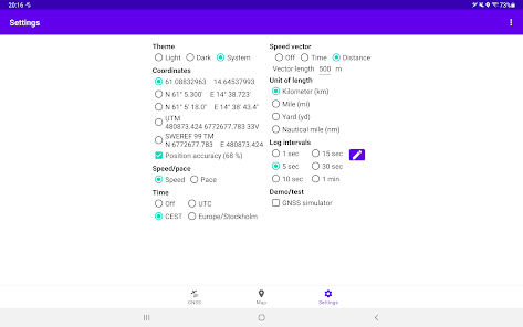
You can also: - Choose between kilometers, miles, yards or nautical miles. - Choose lat/long format (decimal deg, deg/min or deg/min/sec). - Share your position, for example via SMS or e-mail. - Copy position to clipboard. - Set a waypoint. - Clear tracks/waypoints.
This app contains no ads. It does not gather, transmit or disclose any personal data.
More info: https://stigning.se/
Updated on
Aug 20, 2023
Sports
Data safety
arrow_forward
Safety starts with understanding how developers collect and share your data. Data privacy and security practices may vary based on your use, region, and age. The developer provided this information and may update it over time.