
İstanbul City Map
3.7star
319 reviews
50K+
Downloads

Everyone
info

About this app
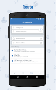
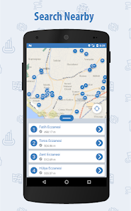
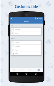
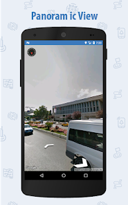
You can use the application for public transportation analysis together with base maps, searching for important places and displaying various layers such as assembly areas, IBB wc points. This app includes many categories. For instance pharmacy, sports facilities, social facilities, etc. Also, you can get information and view panoramic about the location that you press long.
Updated on
Data safety
Developers can show information here about how their app collects and uses your data. Learn more about data safety

No information available
Ratings and reviews
3.7
319 reviews

Some Body
- Flag inappropriate
August 25, 2023
I downloaded this app to view the planned netro lines because you cannot do this in a browser for some reason. Also because the map in Istanbul Senin sucks. Unfortunately, this map doesn't do a better job. It takes a long time to load anything on the map and the app slows down significantly if you add two layers. It is good idea to have all the services in one map, but not like this.

Sirac
- Flag inappropriate
February 1, 2024
güncel uydu görüntülerini ekleyin! webde var burda yok...

A Google user
- Flag inappropriate
December 10, 2017
Hiç birşey güncel değil. 3 yıldır orada yol var sapak var ama hala eski, neden yaptınız bu uygulamayı?
6 people found this review helpful
What's new
Bug fixes and performance improvements.


