
City Air
5K+
Downloads

Everyone
info


About this app
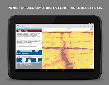
The CityAir app - the healthiest way around London.
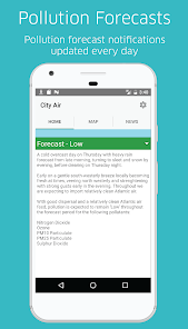
Are you a jogger, cyclist, driver or commuter? Do you know when pollution is high or low?
The CityAir app will alert you on days when pollution is forecast to be high and give you tailored advice on simple actions you can take to reduce your emissions and exposure to air pollution.
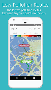
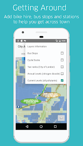
Use the map to plan your journey and easily pick the lowest pollution route through the City - even in 3D!
You are the key to cleaner air.
This application was designed and developed by the City of London Corporation and King's College London.
Are you a jogger, cyclist, driver or commuter? Do you know when pollution is high or low?
The CityAir app will alert you on days when pollution is forecast to be high and give you tailored advice on simple actions you can take to reduce your emissions and exposure to air pollution.
Use the map to plan your journey and easily pick the lowest pollution route through the City - even in 3D!
You are the key to cleaner air.
This application was designed and developed by the City of London Corporation and King's College London.
Updated on
Safety starts with understanding how developers collect and share your data. Data privacy and security practices may vary based on your use, region, and age. The developer provided this information and may update it over time.

No data shared with third parties
Learn more about how developers declare sharing

This app may collect these data types
Location, App activity, and App info and performance

Data is encrypted in transit
What's new
- New launcher icon
- Low pollution route calculations now take account of closed roads in the City of London
- Low pollution route calculations now take account of closed roads in the City of London