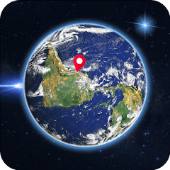
Live Earth Map: GPS Satellite
Contient des annoncesAchats via l'appli
3,8star
42 avis
10K+
Téléchargements

Tout public
info
À propos de l'application
Live Earth map: GPS Satellite is a versatile and user-friendly application that combines cutting-edge technology with satellite navigation systems. It serves as a comprehensive solution for various needs, ranging from basic location tracking to advanced features like Satellite Finder and Real-Time Timelines. Let's explore the key components that make Earth Map Satellite a go-to choice for GPS navigation enthusiasts.
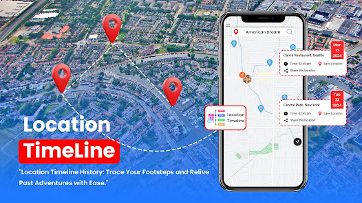
Location Timeline:
One of the fundamental aspects of the Live Earth map: GPS Satellite is its ability to display accurate location-based timeline. Users can easily check the timeline at any location on the globe, allowing for efficient scheduling and coordination across different time zones.
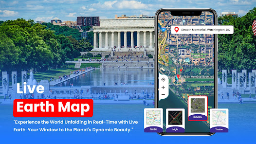
Live Earth Map:
The heart of the module is the Live Earth Map: GPS satellite itself, providing users with a dynamic, real-time representation of the Earth's surface. The map is enriched with up-to-date satellite imagery, offering a vivid and detailed view of landscapes, cities, and geographical features.
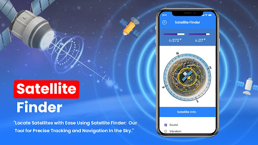
Satellite Finder:
A standout feature of the Live Earth map: GPS satellite is the Satellite Finder tool. Users can track the positions of satellites orbiting the Earth in real-time. This functionality is particularly useful for enthusiasts, researchers, and professionals who require precise information about satellite locations for various purposes.
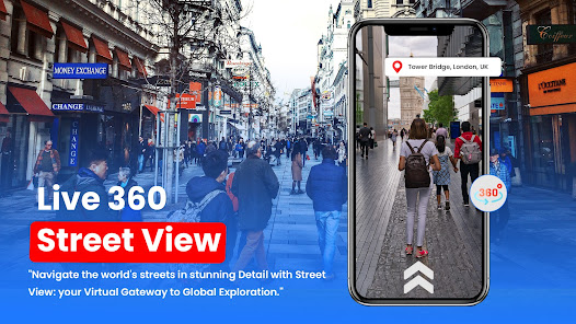
Street View:
Earth Map Satellite goes beyond traditional maps by incorporating a Street View option. Users can virtually explore streets, neighborhoods, and landmarks, gaining a realistic perspective of the environment. This feature is invaluable for both navigation and immersive exploration.
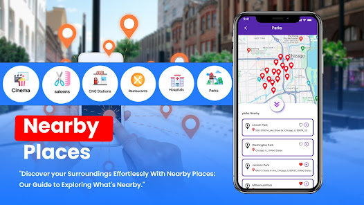
Nearby Places:
The module enhances user convenience by offering a 'Nearby Places' feature. Users can easily locate and explore points of interest, such as restaurants, landmarks, and entertainment venues, providing a seamless integration of navigation and local discovery.
World Clock:
Stay connected with global time zones using the World Clock feature. Whether planning international meetings or keeping track of events across different regions, users can rely on the Live Earth Map: GPS Satellite for accurate and synchronized time information.
Space Wallpaper:
Elevating the user experience, the Space Wallpaper feature allows users to set captivating satellite images or astronomical views as their device wallpaper. This aesthetic touch adds a personalized and visually appealing dimension to the module.
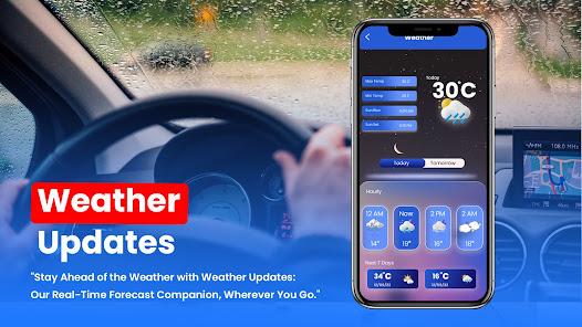
Weather:
Stay informed about current weather conditions with the Live Earth map's integrated weather feature. Users can access real-time updates on temperature, precipitation, and other meteorological data, ensuring a comprehensive understanding of the environment.
Location Timeline:
One of the fundamental aspects of the Live Earth map: GPS Satellite is its ability to display accurate location-based timeline. Users can easily check the timeline at any location on the globe, allowing for efficient scheduling and coordination across different time zones.
Live Earth Map:
The heart of the module is the Live Earth Map: GPS satellite itself, providing users with a dynamic, real-time representation of the Earth's surface. The map is enriched with up-to-date satellite imagery, offering a vivid and detailed view of landscapes, cities, and geographical features.
Satellite Finder:
A standout feature of the Live Earth map: GPS satellite is the Satellite Finder tool. Users can track the positions of satellites orbiting the Earth in real-time. This functionality is particularly useful for enthusiasts, researchers, and professionals who require precise information about satellite locations for various purposes.
Street View:
Earth Map Satellite goes beyond traditional maps by incorporating a Street View option. Users can virtually explore streets, neighborhoods, and landmarks, gaining a realistic perspective of the environment. This feature is invaluable for both navigation and immersive exploration.
Nearby Places:
The module enhances user convenience by offering a 'Nearby Places' feature. Users can easily locate and explore points of interest, such as restaurants, landmarks, and entertainment venues, providing a seamless integration of navigation and local discovery.
World Clock:
Stay connected with global time zones using the World Clock feature. Whether planning international meetings or keeping track of events across different regions, users can rely on the Live Earth Map: GPS Satellite for accurate and synchronized time information.
Space Wallpaper:
Elevating the user experience, the Space Wallpaper feature allows users to set captivating satellite images or astronomical views as their device wallpaper. This aesthetic touch adds a personalized and visually appealing dimension to the module.
Weather:
Stay informed about current weather conditions with the Live Earth map's integrated weather feature. Users can access real-time updates on temperature, precipitation, and other meteorological data, ensuring a comprehensive understanding of the environment.
Date de mise à jour
La sécurité, c'est d'abord comprendre comment les développeurs collectent et partagent vos données. Les pratiques concernant leur confidentialité et leur protection peuvent varier selon votre utilisation, votre région et votre âge. Le développeur a fourni ces informations et peut les modifier ultérieurement.

Aucune donnée partagée avec des tiers
En savoir plus sur la manière dont les développeurs déclarent le partage

Aucune donnée collectée
En savoir plus sur la manière dont les développeurs déclarent la collecte

Les données ne sont pas chiffrées
Impossible de supprimer les données
Nouveautés
✔️Enhanced user interface for smoother navigation and improved user experience.
✔️Improved performance and stability for seamless usage on all devices.
✔️Fixed minor bugs and issues reported by our users.
🌎Update now to enjoy the latest features and enhancements in Live Earth Map! Explore the world like never before.
✔️Improved performance and stability for seamless usage on all devices.
✔️Fixed minor bugs and issues reported by our users.
🌎Update now to enjoy the latest features and enhancements in Live Earth Map! Explore the world like never before.


