Vindskyddskartan (Shelter Map)
Køb i apps
10 t+
Downloads

Alle
info
Om denne app
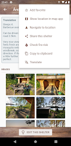
Do you want to enjoy wilderness to the fullest and spend the night outdoors? Or perhaps you're just looking for a nice place to have a "fika pause" during a hike? There are plenty of hiking shelters all around, but finding them is usually not easy.
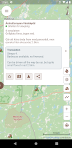
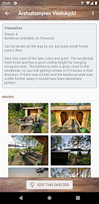
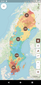
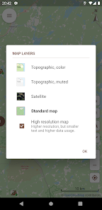
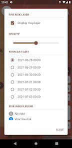
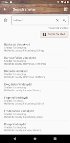
Vindskyddskartan (which means "Shelter map" in Swedish) gives you an easy to use overview of thousands of shelters on a map so you can easily find one near your location. The app also gives you easy access to current and forecasted fire risk and fire ban status, so you know when, where and how you can safely enjoy a campfire and cook food in nature.
The app is subscription based, but you can try it for free for 3 days before paying anything. If you prefer to own your apps, you can make a one-time purchase and have unlimited lifetime access to the app. All purchases are made from within the app. Subscriptions renew automatically unless cancelled at least 24 hours before the next renewal. Active subscriptions are managed from the Google Play app, and of course you may cancel your subscription at any time.
Opdateret
For at du kan beskytte dine data, er det vigtigt at sætte sig ind i, hvordan udviklere indsamler og deler disse data. Databeskyttelses- og sikkerhedsprocedurer kan variere afhængigt af din brug, din region og din alder. Udvikleren har leveret disse oplysninger og kan løbende opdatere dem.


Nyheder
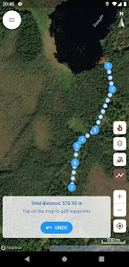
Förbättrad visning av GPX-filer, inklusive förbättrad prestanda för stora filer med långa spår samt visning av rutter och waypoints.
Support til app
Om udvikleren
MangoData AB
contact@mangodata.se
Skogås Gård Älmhult 6326
242 95 Hörby
Sweden
+46 8 559 184 00


