

Elevation and Sea Depth
Contains adsIn-app purchases

5.0star
138 reviews
50K+
Downloads

Everyone
info
About this app
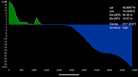
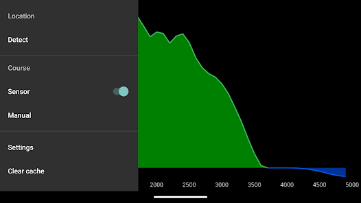
Displays elevation and/or sea depth (terrain/elevation profile) in the direction of the phone. Useful for hiking, trekking, mountaineering and fishing.
* 5km range
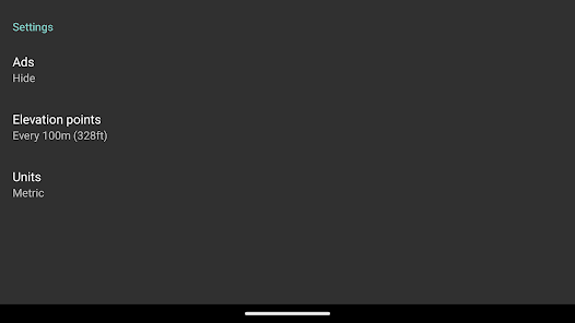
* ele. pts every 10m/100m horizontally
* directions rounded to 30° steps
Hold phone on flat surface and away from ferrous metal objects and electromagnetic fields.
* 5km range
* ele. pts every 10m/100m horizontally
* directions rounded to 30° steps
Hold phone on flat surface and away from ferrous metal objects and electromagnetic fields.
Updated on
Safety starts with understanding how developers collect and share your data. Data privacy and security practices may vary based on your use, region and age. The developer provided this information and may update it over time.

No data shared with third parties
Learn more about how developers declare sharing

This app may collect these data types
Location and Device or other IDs

Data is encrypted in transit

You can request that data be deleted
Ratings and reviews
5.0
132 reviews

Cool Math (Samir)
- Flag inappropriate
16 July 2021
Did not work
Binary Solutions
25 April 2024
Please update to the latest version 5.1 and tell us how it went through.

A Google user
- Flag inappropriate
24 June 2014
Fair Seas & Tradewinds
10 people found this review helpful
Binary Solutions
25 April 2024
Thank you for your support
A Google user
- Flag inappropriate
30 April 2012
Runs the battery down but that's fair. The primary function of the app is to turn on/off the light....but the on/off button doesnt stand out very well when stumbling around in the dark.
2 people found this review helpful
Binary Solutions
25 April 2024
Please check the latest version and it's primary function.
What's new
* not overlapping user interface with android system buttons
App support
About the developer
BINARNA RJESENJA, vl. Viktor Bresan
support@binarysolutions.biz
Hrvatskih Vitezova 11
21251, Gornje Sitno
Croatia
+385 97 600 4236


