
MapMyCrop: Crop Monitoring

3.1star
373 reviews

Everyone
info
100K+
Downloads

Everyone
Learn more


About this app
Monitor Your Crops with Satellite Technology - Smart Farming Made Simple
MapMyCrop is an advanced crop monitoring and precision agriculture app that helps farmers, agronomists, and agricultural consultants maximize yields and reduce costs using satellite imagery, AI-powered insights, and real-time field analytics.
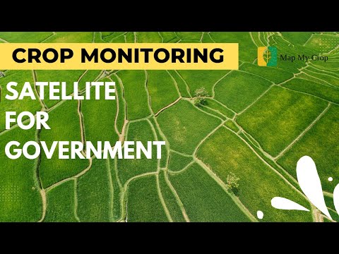
🛰️ SATELLITE CROP MONITORING
Track crop health across all your fields with multi-spectral satellite imagery and vegetation indices (NDVI, NDRE, MSAVI). Detect stress, disease, and nutrient deficiencies before they impact your harvest. Get cloud-free imagery and historical field data to make informed decisions.
KEY FEATURES FOR MODERN FARMING
Variable Rate Application (VRA) Maps
Generate precision VRA maps for fertilizer, pesticides, and seed application. Optimize input costs by applying resources only where needed based on real soil and crop variability.
AI Crop Advisor & Disease Detection
Get AI-powered recommendations for irrigation, fertilization, pest control, and disease management. Early detection algorithms analyze current conditions and weather forecasts to help you stay ahead of crop threats.
Smart Irrigation & Fertigation Scheduler
Automate watering and nutrient schedules based on crop requirements, soil moisture, weather data, and growth stages. Save water and optimize nutrient delivery for maximum efficiency.
Comprehensive Field Analytics
Access multiple vegetation indices, soil moisture maps, temperature monitoring, and field zonation. Understand field variability and make data-driven farming decisions.
Weather Integration & Forecasting
14-day weather forecasts with rainfall predictions, temperature trends, and wind conditions. Plan field operations with confidence and protect crops from adverse weather.
Field Activity Management
Track all farming operations including planting, spraying, fertilizing, irrigation, and harvesting. Log activities, assign tasks to team members, and monitor costs in one centralized platform.
Scouting Reports & Problem Zones
Mark problem areas directly on field maps, create detailed scouting reports with photos, and share insights with your team or agronomists instantly.
PERFECT FOR
- Commercial farmers managing multiple fields
- Agricultural consultants and crop advisors
- Farm managers and agribusiness operators
- Cooperatives and farming organizations
- Banks and insurance companies assessing crop performance
PRECISION AGRICULTURE BENEFITS
✓ Increase crop yields by 15-30% with data-driven decisions
✓ Reduce input costs through variable rate application
✓ Save 20-40% on water and fertilizer expenses
✓ Detect crop stress 2-3 weeks before visible symptoms
✓ Improve farm profitability and sustainability
✓ Make informed decisions backed by satellite data
WORKS GLOBALLY - OFFLINE CAPABLE
Monitor fields anywhere in the world with satellite coverage. Download field data and maps for offline access in remote areas with limited connectivity.
SIMPLE, POWERFUL INTERFACE
New clean UI designed for ease of use in the field. No learning curve - start monitoring crops in minutes. Smooth performance optimized for all Android devices.
CONTINUOUS UPDATES & SUPPORT
We're constantly improving MapMyCrop with new features, bug fixes, and enhanced analytics. Our support team is ready to help you maximize your farming success.
FREE TO START
Create an account and add your first fields for free. Experience the power of satellite-based crop monitoring before upgrading to premium features.
Transform your farming operations with satellite intelligence. Download MapMyCrop today and join thousands of farmers who are making smarter, more profitable decisions.
Keywords: crop monitoring, satellite imagery, precision agriculture, farm management, NDVI, vegetation index, VRA maps, agricultural app, field scouting, smart farming, agritech, crop health, irrigation management, farm productivity, yield optimization
MapMyCrop is an advanced crop monitoring and precision agriculture app that helps farmers, agronomists, and agricultural consultants maximize yields and reduce costs using satellite imagery, AI-powered insights, and real-time field analytics.
🛰️ SATELLITE CROP MONITORING
Track crop health across all your fields with multi-spectral satellite imagery and vegetation indices (NDVI, NDRE, MSAVI). Detect stress, disease, and nutrient deficiencies before they impact your harvest. Get cloud-free imagery and historical field data to make informed decisions.
KEY FEATURES FOR MODERN FARMING
Variable Rate Application (VRA) Maps
Generate precision VRA maps for fertilizer, pesticides, and seed application. Optimize input costs by applying resources only where needed based on real soil and crop variability.
AI Crop Advisor & Disease Detection
Get AI-powered recommendations for irrigation, fertilization, pest control, and disease management. Early detection algorithms analyze current conditions and weather forecasts to help you stay ahead of crop threats.
Smart Irrigation & Fertigation Scheduler
Automate watering and nutrient schedules based on crop requirements, soil moisture, weather data, and growth stages. Save water and optimize nutrient delivery for maximum efficiency.
Comprehensive Field Analytics
Access multiple vegetation indices, soil moisture maps, temperature monitoring, and field zonation. Understand field variability and make data-driven farming decisions.
Weather Integration & Forecasting
14-day weather forecasts with rainfall predictions, temperature trends, and wind conditions. Plan field operations with confidence and protect crops from adverse weather.
Field Activity Management
Track all farming operations including planting, spraying, fertilizing, irrigation, and harvesting. Log activities, assign tasks to team members, and monitor costs in one centralized platform.
Scouting Reports & Problem Zones
Mark problem areas directly on field maps, create detailed scouting reports with photos, and share insights with your team or agronomists instantly.
PERFECT FOR
- Commercial farmers managing multiple fields
- Agricultural consultants and crop advisors
- Farm managers and agribusiness operators
- Cooperatives and farming organizations
- Banks and insurance companies assessing crop performance
PRECISION AGRICULTURE BENEFITS
✓ Increase crop yields by 15-30% with data-driven decisions
✓ Reduce input costs through variable rate application
✓ Save 20-40% on water and fertilizer expenses
✓ Detect crop stress 2-3 weeks before visible symptoms
✓ Improve farm profitability and sustainability
✓ Make informed decisions backed by satellite data
WORKS GLOBALLY - OFFLINE CAPABLE
Monitor fields anywhere in the world with satellite coverage. Download field data and maps for offline access in remote areas with limited connectivity.
SIMPLE, POWERFUL INTERFACE
New clean UI designed for ease of use in the field. No learning curve - start monitoring crops in minutes. Smooth performance optimized for all Android devices.
CONTINUOUS UPDATES & SUPPORT
We're constantly improving MapMyCrop with new features, bug fixes, and enhanced analytics. Our support team is ready to help you maximize your farming success.
FREE TO START
Create an account and add your first fields for free. Experience the power of satellite-based crop monitoring before upgrading to premium features.
Transform your farming operations with satellite intelligence. Download MapMyCrop today and join thousands of farmers who are making smarter, more profitable decisions.
Keywords: crop monitoring, satellite imagery, precision agriculture, farm management, NDVI, vegetation index, VRA maps, agricultural app, field scouting, smart farming, agritech, crop health, irrigation management, farm productivity, yield optimization
Updated on
Safety starts with understanding how developers collect and share your data. Data privacy and security practices may vary based on your use, region, and age. The developer provided this information and may update it over time.

No data shared with third parties
Learn more about how developers declare sharing

This app may collect these data types
Personal info and Device or other IDs

Data is encrypted in transit

You can request that data be deleted
Ratings and reviews
368 reviews

Farida khatun
- Flag inappropriate
March 30, 2026
I found the pesticide calculator very useful it helps in using the right quantity and avoids unnecessary waste which is important
3 people found this review helpful

Baishakhi Biswas
- Flag inappropriate
March 29, 2026
I like how this app provides weather updates and crop advice in one place it really helps in planning farming activities better and saving time
3 people found this review helpful

Elena Lopez
- Flag inappropriate
February 26, 2023
I discovered this application to be truly handy. It has a great deal of functions and also the crop advisor is actually educated. It also has weather report, so you can prepare your crops based upon that. I also such as that it has a searching device, so you can see just how the plants are doing as well as if there are any bugs or diseases. Overall, I assume this is a wonderful app and I would certainly recommend it to other farmers.
43 people found this review helpful
Map My Crop
February 28, 2023
Thanks for your review! Please recommend our app to your friends, and don’t hesitate to shoot us a note at info@mapmycrop.com if you have any questions.
What’s new
Added New Water Scheduler (Beta).
Bug fixes and performance improvements.
Bug fixes and performance improvements.
Everyone
Learn moreApp support
phone
Phone number
+19174143909
About the developer
Hardcastle Agrotech Solutions Inc.
swapnil@mapmycrop.com
1 World Trade Ctr Ste 8500
New York, NY 10007
United States
+91 83088 42933


