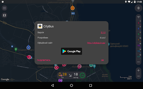
CityBus Odesa
Contains adsIn-app purchases
50K+
Downloads

Mature 17+
info
About this app
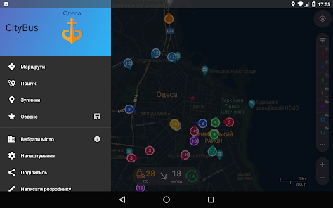
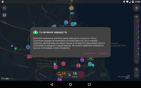
Smart app for online tracking public transport of Odesa
* ATTENTION! App shows in real time only electric transport of Odesa. There is no tracking of buses, as it requires installation of GPS trackers on all buses, which is currently not a mandatory condition for the provision of passenger transportation services in Odesa. Main app function - transport tracking - depends on the functioning of an external source of GPS data. Cooperation of the source and app is not guaranteed. Also, given the significant intervals of data updates sometimes, there may be some differences between the real transport position and the application shown.
If you have something which does not work/open/buzz - to get a complete answer write me an e-mail (my address has to be at the bottom of the page; it is desirable to attach a screenshot of the problem), because the size of the review response is limited.
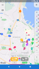
- Only actual information. CityBus filters data not to show you things, which aren't there.
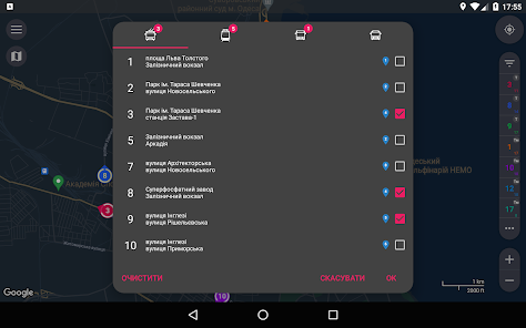
- Favourites. CityBus gives you possibility to save your favourite routes lists and apply them in just a couple of taps.
- Detailed view. On map zoom in you will see all vehicles, equipped with gps-trackers, not only of selected routes.
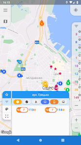
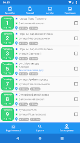
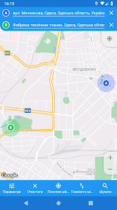
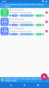
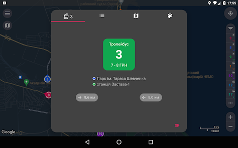
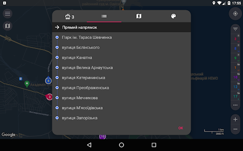
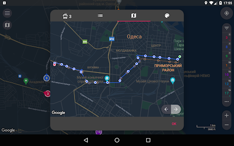
- Routes search. You only need to choose two points on a map, search results could be filtered and applied to display suitable vehicles. Stops, routes, route paths - everything is already within an app and doesn't need to be loaded.
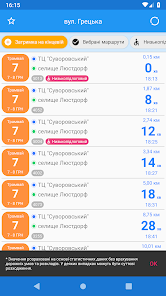
- Real-time transition. Received info about coordinates, speed and heading is enough to predict with high probability real-time vehicle location. Displaying movement on a map is animated, almost no jumps.
- Traffic optimization. It's impossible to show current location of vehicles without data transmission. But as for the rest - such as information about routes, route paths, stops - it's not only possible, it should be accessible without using network. It's exactly how it is implemented in CityBus - all useful info is already inside this app.
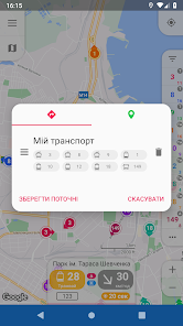
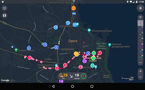
- Speed and heading visualization. Only one glance at map allows you to determine heading and speed of vehicles you need. Depending on speed changes size of colored area of ring around marker, and its centre points in a direction the bus is heading.
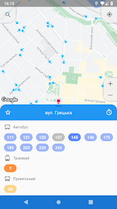
- Color routes identification. Distinguishing routes is quite easy, 'cause every selected route is determined not only by its number, but although by color of its marker.
* ATTENTION! App shows in real time only electric transport of Odesa. There is no tracking of buses, as it requires installation of GPS trackers on all buses, which is currently not a mandatory condition for the provision of passenger transportation services in Odesa. Main app function - transport tracking - depends on the functioning of an external source of GPS data. Cooperation of the source and app is not guaranteed. Also, given the significant intervals of data updates sometimes, there may be some differences between the real transport position and the application shown.
If you have something which does not work/open/buzz - to get a complete answer write me an e-mail (my address has to be at the bottom of the page; it is desirable to attach a screenshot of the problem), because the size of the review response is limited.
- Only actual information. CityBus filters data not to show you things, which aren't there.
- Favourites. CityBus gives you possibility to save your favourite routes lists and apply them in just a couple of taps.
- Detailed view. On map zoom in you will see all vehicles, equipped with gps-trackers, not only of selected routes.
- Routes search. You only need to choose two points on a map, search results could be filtered and applied to display suitable vehicles. Stops, routes, route paths - everything is already within an app and doesn't need to be loaded.
- Real-time transition. Received info about coordinates, speed and heading is enough to predict with high probability real-time vehicle location. Displaying movement on a map is animated, almost no jumps.
- Traffic optimization. It's impossible to show current location of vehicles without data transmission. But as for the rest - such as information about routes, route paths, stops - it's not only possible, it should be accessible without using network. It's exactly how it is implemented in CityBus - all useful info is already inside this app.
- Speed and heading visualization. Only one glance at map allows you to determine heading and speed of vehicles you need. Depending on speed changes size of colored area of ring around marker, and its centre points in a direction the bus is heading.
- Color routes identification. Distinguishing routes is quite easy, 'cause every selected route is determined not only by its number, but although by color of its marker.
Updated on
Safety starts with understanding how developers collect and share your data. Data privacy and security practices may vary based on your use, region and age The developer provided this information and may update it over time.


What's new
- Redesign of controls in the map area (list of selected routes, information about transport, buttons, etc.)
- Block of information about the selected transport: added the final destination and the vehicle model; clicking on the colored block with the route number shows/hides the route on the map
- Search history: previously searched points will appear in the tooltips of the address input fields
- Icons for tooltips in the address input fields depending on the type (history, stops, addresses)


