
WRPElevationChart

100+
Downloads

Everyone
info


About this app
A 'lightweight' GPX, TCX, KML/KMZ- and FIT File viewer app limited to the basics.
Core functions:
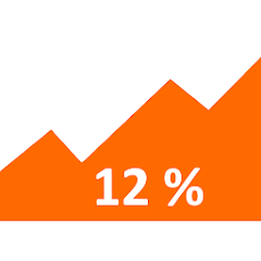
- With this elevation chart creator you can create on-the-fly 2D elevation charts, you only must be aware of distance and elevation values.
- The imported GPS tracks can be visualized as an elevation chart (start with version 2.0 also in 3D), which is synchronized with the map view.
- With the sharing function, the imported GPS data can be converted internally into GPX format and transferred to other apps (the FIT file format is currently still supported by relatively few Android apps, so this 'conversion' into GPX format can be very useful).
- Using the integrated browser mode, it is possible to browse through the GPX/TCX/KML/FIT files on your device in order to better manage route/track data and, for example, to pass it on more easily to the Garmin Connect app (unfortunately since Android 11 access to the download folder is restricted for normal apps (= no system apps) -> therefore it is best to store the track/activties files in a special folder on your devices -> e.g. this could be a sub folder within the download folder).
- Enter distance and altitude values
- Calculation of the slope percentages
- Assignment of a title (= caption of elevation chart)
- Elevation chart creation (imperial or metric axis are supported)
- Save/restore the created profile data (XML format)
- Calculation of the ascent-/descent meter (feet) (adjustable hysteresis factor!)
- Import of * .GPX, * .TCX, *.KML/KMZ, * .SRP and ('Garmin') *.FIT files (GPS based data)
- Track display as map view (OSMDroid)
- Track animation (Virtual ride)
- Compatibility with the also very lightweight app 'GPS Logger' (BasicAirData)
- (Garmin) Fit File Import (only GPS coordinates, altitude values, SPD, distance and time stamp)
- Improved sharing functionality -> for example, the imported data can be transferred to the Garmin Connect app as a route via the sharing function.
- Optional display of the speed curve (can be faded in and out)
- Optional autoscaling of elevation chart.
- GPX-/KML file export (Google Earth transfers)
- Track and elevation chart viewer for various apps (e.g. Wahoo Elemnt App, Beeline App)
- (New) X-axis can now optionally be displayed as a time based axis (only if the import data contain time stamps -> long-tap the elevation chart to switch)
- (New in Ver. 2.0) 3D GPS track elevation chart (similar to the 3D track view of the Windows programs GPS-Track-Analyse and TrainingLab Pro)
This app needs some special PERMISSIONS:
Write and Read permissions [WRITE_EXTERNAL_STORAGE, READ_EXTERNAL_STORAGE]
a) for optional storage of the height profile data
b) for creation of an optional screenshot graphic if you want to use the share functionality, which does nothing else than transfer a screenshot graphic file to another app
c) for caching the map tiles (OSMDroid)
Location data [ACCESS_COARSE_LOCATION, ACCESS_FINE_LOCATION]
ONLY needed if you want to use the 'JumpTo'-Home functionality in the map view, which does nothing more than center the map to the last known location! This app DOES NOT (currently) offer any GPS logging (tracking) functionality!
Network permissions [INTERNET, ACCESS_NETWORK_STATE]
Required to download the map tiles.
ATTENTION: When using the map view, DATA (map sections, so-called tiles) are DOWNLOADED from the Internet. This can lead to corresponding costs when using a mobile data connection. A WLAN connection or a mobile data flat rate is therefore strongly recommended!
An online manual (currently only in German, but Google translate service would surely help) is available on my blog: https://wrpsoft.blogspot.com/2021/02/wrpelevationchart-anleitung.html
*For more informations regarding the HRMProfil and TrainingLab Pro projects please check: https://www.hrmprofil.de
Core functions:
- With this elevation chart creator you can create on-the-fly 2D elevation charts, you only must be aware of distance and elevation values.
- The imported GPS tracks can be visualized as an elevation chart (start with version 2.0 also in 3D), which is synchronized with the map view.
- With the sharing function, the imported GPS data can be converted internally into GPX format and transferred to other apps (the FIT file format is currently still supported by relatively few Android apps, so this 'conversion' into GPX format can be very useful).
- Using the integrated browser mode, it is possible to browse through the GPX/TCX/KML/FIT files on your device in order to better manage route/track data and, for example, to pass it on more easily to the Garmin Connect app (unfortunately since Android 11 access to the download folder is restricted for normal apps (= no system apps) -> therefore it is best to store the track/activties files in a special folder on your devices -> e.g. this could be a sub folder within the download folder).
- Enter distance and altitude values
- Calculation of the slope percentages
- Assignment of a title (= caption of elevation chart)
- Elevation chart creation (imperial or metric axis are supported)
- Save/restore the created profile data (XML format)
- Calculation of the ascent-/descent meter (feet) (adjustable hysteresis factor!)
- Import of * .GPX, * .TCX, *.KML/KMZ, * .SRP and ('Garmin') *.FIT files (GPS based data)
- Track display as map view (OSMDroid)
- Track animation (Virtual ride)
- Compatibility with the also very lightweight app 'GPS Logger' (BasicAirData)
- (Garmin) Fit File Import (only GPS coordinates, altitude values, SPD, distance and time stamp)
- Improved sharing functionality -> for example, the imported data can be transferred to the Garmin Connect app as a route via the sharing function.
- Optional display of the speed curve (can be faded in and out)
- Optional autoscaling of elevation chart.
- GPX-/KML file export (Google Earth transfers)
- Track and elevation chart viewer for various apps (e.g. Wahoo Elemnt App, Beeline App)
- (New) X-axis can now optionally be displayed as a time based axis (only if the import data contain time stamps -> long-tap the elevation chart to switch)
- (New in Ver. 2.0) 3D GPS track elevation chart (similar to the 3D track view of the Windows programs GPS-Track-Analyse and TrainingLab Pro)
This app needs some special PERMISSIONS:
Write and Read permissions [WRITE_EXTERNAL_STORAGE, READ_EXTERNAL_STORAGE]
a) for optional storage of the height profile data
b) for creation of an optional screenshot graphic if you want to use the share functionality, which does nothing else than transfer a screenshot graphic file to another app
c) for caching the map tiles (OSMDroid)
Location data [ACCESS_COARSE_LOCATION, ACCESS_FINE_LOCATION]
ONLY needed if you want to use the 'JumpTo'-Home functionality in the map view, which does nothing more than center the map to the last known location! This app DOES NOT (currently) offer any GPS logging (tracking) functionality!
Network permissions [INTERNET, ACCESS_NETWORK_STATE]
Required to download the map tiles.
ATTENTION: When using the map view, DATA (map sections, so-called tiles) are DOWNLOADED from the Internet. This can lead to corresponding costs when using a mobile data connection. A WLAN connection or a mobile data flat rate is therefore strongly recommended!
An online manual (currently only in German, but Google translate service would surely help) is available on my blog: https://wrpsoft.blogspot.com/2021/02/wrpelevationchart-anleitung.html
*For more informations regarding the HRMProfil and TrainingLab Pro projects please check: https://www.hrmprofil.de
Updated on
Safety starts with understanding how developers collect and share your data. Data privacy and security practices may vary based on your use, region and age The developer provided this information and may update it over time.

No data shared with third parties
Learn more about how developers declare sharing

No data collected
Learn more about how developers declare collection
What's new
2.0.31: - Some new options in the settings (line thickness curves, base plate type 3D chart), new gestures, tidied up manifest and some more.
2.0.30: - new optional data series (HF, power, cadence)
- text export (CSV file) and much more
- adjustments for Android 14 (API level 34)
2.0.21: - optionally open external map app (e.g. Google Maps) (long touch gesture in the map view)
- ÖPVN map added
2.0.20: - Added distance measurement tool (ruler symbol)
...
2.0.0: 3D (GPS) elevation chart


