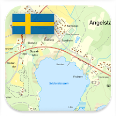
Sweden Topo Maps
Contains adsIn-app purchases
4.5star
3.39K reviews

Everyone
info
100K+
Downloads


About this app
Sweden Topo Maps – Offline GPS Navigation for Outdoor Use
Turn your Android phone or tablet into a powerful offline GPS navigation system for Sweden. Perfect for hiking, cycling, and outdoor activities in areas without mobile coverage.
Explore detailed topographic maps, aerial imagery, and satellite maps with advanced navigation tools – similar to professional GPS devices.
Topographic Maps and Aerial Imagery (Free)
Access high-quality maps for Sweden and worldwide:
• Lantmäteriet Topographic Maps (Topowebb, Terrängkartan, Fjällkartan) with high-resolution LiDAR hillshade
• Lantmäteriet Aerial Imagery
• 1:50,000 Topographic Maps for Scandinavia (Sweden, Norway, Finland, Denmark)
• AtloMaps OSM Maps with hillshading (worldwide)
• CyclOSM maps for cycling routes
• ESRI Topographic, Aerial, and Street Maps (online only)
• Google Maps and Satellite (online only)
• Bing Maps and Satellite (online only)
• Earth at Night
Outdoor GPS Navigation Features
Reliable navigation tools for outdoor use:
• Record GPS tracks with distance, speed, elevation, and accuracy
• Trip master with customizable data fields (speed, altitude, bearing, distance, etc.)
• Create and manage waypoints
• Go-to waypoint navigation
• Measure distances and areas
• Compare maps with transparency (fade between map layers)
• Search for places, addresses, and POIs
• Display coordinates in Lat/Lon, UTM, or MGRS/USNG
• Rotate map (North Up / Track Up)
• Get elevation and distance by tapping the map
• Track replay
• Export and share data (GPX, KML, KMZ)
Map Overlays (Free)
Enhance maps with additional layers:
• Hiking, cycling, MTB, and winter sports routes
• 10 m contour lines
• Hillshade overlay
Pro Features (In-App Purchase)
Unlock advanced offline navigation:
• Full offline GPS navigation without mobile signal
• Bulk download of maps for offline use
• Route navigation with automatic routing (hiking and cycling profiles)
• Create and edit routes
• Import GPX, KML, KMZ files
• Unlimited waypoints and tracks
• Add custom map tile servers (WMS and raster maps)
• No ads
Offline Maps and Navigation
All viewed map tiles are cached automatically.
Download larger areas in advance and use the app completely offline without roaming costs.
Outdoor Activities
Ideal for hiking, cycling, MTB, camping, skiing, climbing, canoeing, aviation, hunting, off-road navigation, and search and rescue (SAR).
GPS Data and Formats
Create and use waypoints in Lat/Lon, UTM, or MGRS/USNG (WGS84).
Import, export, and share GPS data in GPX or Google Earth KML/KMZ format.
Privacy
No tracking. No data collection. Your location data stays on your device.
Support:
support@atlogis.com
More apps: https://play.google.com/store/apps/developer?id=ATLOGIS+Geoinformatics+GmbH+%26+Co.+KG
Updated on
Safety starts with understanding how developers collect and share your data. Data privacy and security practices may vary based on your use, region, and age. The developer provided this information and may update it over time.

This app may share these data types with third parties
Personal info, App activity and 2 others

No data collected
Learn more about how developers declare collection

Data is encrypted in transit

You can request that data be deleted
Ratings and reviews
4.5
3.02K reviews

Konstantin Ku
- Flag inappropriate
- Show review history
January 29, 2026
Perfect if you are outside urban areas in Sweden. Skiing, hiking, fishing etc. Topographic maps is what you need... gmaps can't compete at all. UPD: I use it for about 2 years and like it even more. Super fast and accurate tracking, no matter if your walk or drive. Helps me a lot in my travels. I bought Pro version from beginning. Well designed UI, very fast start. Its just great! You don't need Garmin if you have this. Its one of the best app I have in my phone!
8 people found this review helpful

K Ver
- Flag inappropriate
- Show review history
April 13, 2026
Great app. I used it to cross Sarek national park. Even beter info and map then Garmin explorer

Ross B
- Flag inappropriate
August 2, 2025
I've liked this app for years. But now, after having used Norway Topo Maps, I'm quite disappointed. It's a significantly different experience simply from the perspective of reading the map. The Norway map automatically adjusts the contour scale while zooming in and out in a fantastically useful way. The Sweden map is just zooming in and out on a picture of a map. It would be great if the Sweden map could function like the Norway map.
What’s new
・Nya överlägg för Vintersport och MTB
・Buggfixar och förbättringar
・Buggfixar och förbättringar
App support
About the developer
Atlogis Geoinformatics GmbH & Co. KG
support@atlogis.com
Unter den Ulmen 8
33330 Gütersloh
Germany
+49 5241 4032281


